aumkartourstravels.com

Uttranchal (2)
Uttranchal (3)
Uttranchal
previous arrow
next arrow

Beautiful Uttaranchal

a place where you see the real heaven

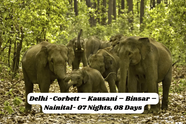
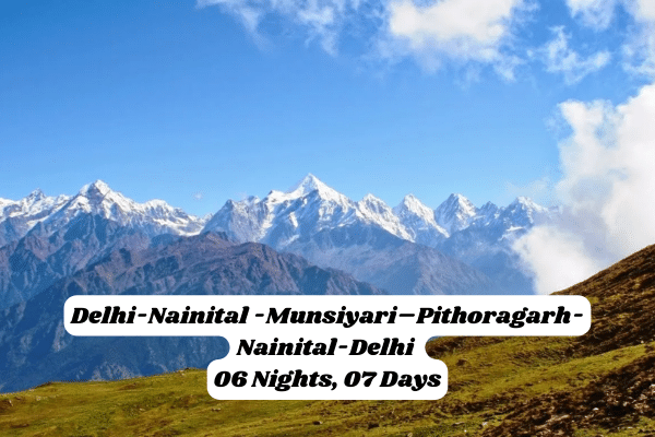
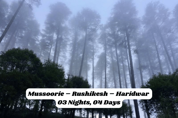
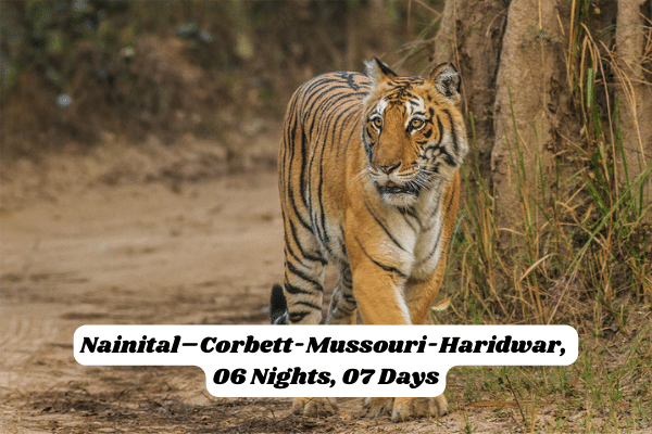
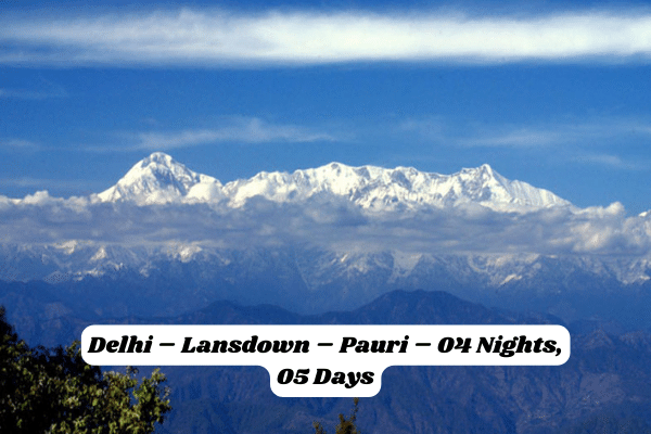
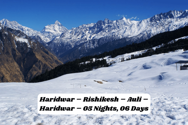
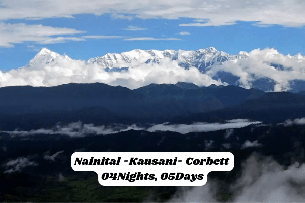
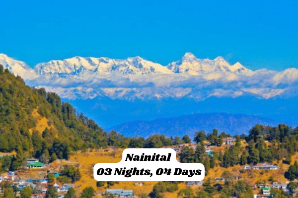
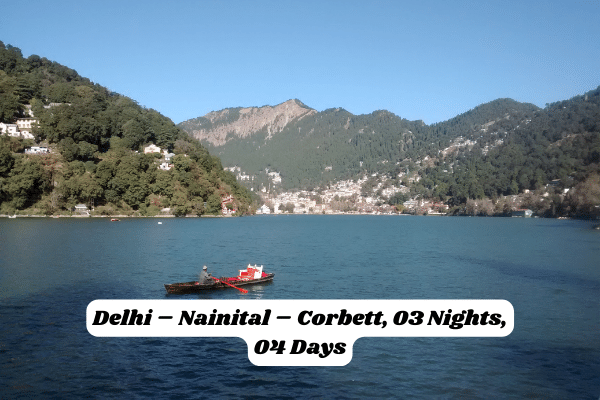
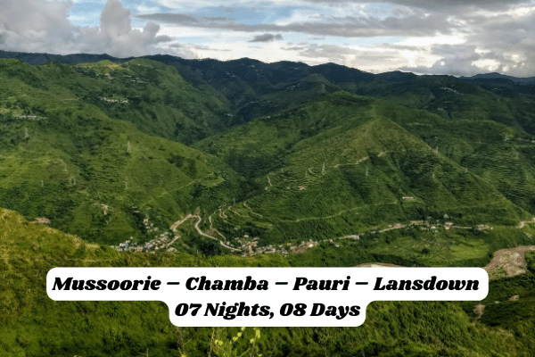
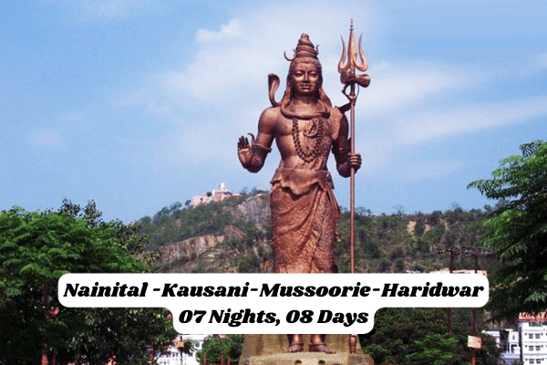
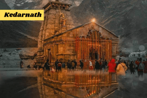
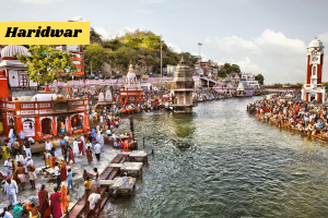
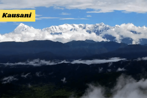
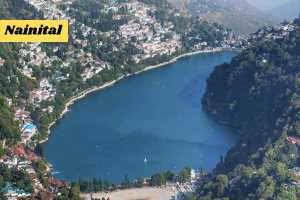
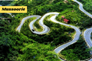
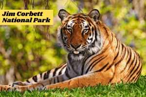
The combined region of Kumaon and Garhwal has been known as Uttarakhand since the time of the Puranas, the ancient Hindu scriptures. Uttarakhand, the 27th state of India, is often referred as the Land of Gods. It is a place blessed with the beauty of heaven and the grace of Gods. This is the place where the rivers passing through the huge rocks and wind passing through large pine trees produces a natural melody by itself. It was carved out of the state of Uttar Pradesh on November 9, 2000. It is one of the most beautiful state in the Indian union. Apart from the beautiful views of Himalayas, it is also home of the point of origin of Ganga and Yamuna. Gangotri, Yamunotri, Badrinath and Kedarnath are some of the places regarded sacred by Hindus. Uttarakhand borders China in the north and Nepal to the east, while its neighbour states are Himachal Pradesh to the west and Uttar in the south. The region is traditionally referred to as Uttarakhand in old literature and scriptures which derives from the Sanskrit for North Country. The provisional capital of Uttarakhand is Dehra Dun which is also a rail-head and the largest city in the region. The small hamlet of Gairsen has been mooted as the future capital owing to its geographic centrality but controversies and lack of resources have led Dehra Dun to be the provisional capital. The High Court of Uttarakhand is situated in Nainital though most of the litigation is in Dehra Dun or Haridwar. Uttarakhand is a region of outstanding natural beauty. Most of the northern parts of the state are part of Greater Himalaya ranges, covered by the high Himalayan peaks and glaciers, while the lower foothills were densely forested till denuded by the British log merchants and forest contractors after independence. Recent efforts in forestation, however, have been sucessful in restoring the situation to some extent. The unique Himalayan ecosystem plays host to a large number of animals (including bharal, snow leopards, leopards and tigers), plants and rare herbs. Two of India's mightiest rivers, the Ganga and the Yamuna take birth in the glaciers of Uttarakhand, and are fed by myriad lakes, glacial melts and streams in the region. The tourism industry is a major contributor to the economy of Uttarakhand, with the Corbett National Park and Tiger Reserve and the nearby hill-stations of Nainital and Bhimtal and several other hill-stations like Mussoorie, Almora and Ranikhet being among the most frequented destinations of India. To this region also belong some of the holiest Hindu shrines, and for almost 2000 years now, pilgrims have been visiting the temples at Haridwar, Badrinath, Kedarnath and Jageshwar in the hope of salvation and purification from sin. Rishikesh near Haridwar has the major spiritual and yoga centers of India. Gangotri and Yamnotri, the sources of the Ganges and Yamuna also fall in this region and are revered by many. Besides these most popular pilgrim centers, the state has an abundance of temples and shrines, references to most of which can be found in Hindu scriptures and legends. The architecture of most of these temples is typical of the region and slightly different from other parts of India, the ancient temples at Jageshwar being the most popular for their architectural importance. Uttarakhand is comprised of two regions, the western half known as Garhwal and the eastern region going by the name of Kumaon, the two having different chieftains in history and different lingual and cultural influences due to proximity and neighbourhood of different cultures. Inseparable and complementary nature of their geography, economy, culture, language and traditions, however, have formed strong bondages between the two regions. Recent developments in the region include initiatives by the state government to capitalize on the burgeoning tourist trade as well as tax incentives to lure high-tech industry to the state. The state also has big-dam projects, controversial and often criticised in India, such as the very large Tehri dam on the Bhagirathi-Bhilangana rivers, conceived in 1953 and about to to reach completion.

Nainital is a glittering jewel in the Himalyan necklace, blessed with scenic natural splendour and varied natural resources. Dotted with lakes, Nainital has earned the epithet of “Lake District” of India. The most prominent of the lakes is Naini Lake ringed by hills. Nainital has a varied topography. Some of the important places in the district are Nainital, Haldwani, Kaladhungi, Ramnagar, Bhowali, Ramgarh, Mukteshwar, Bhimtal, Sattal and Naukuchiatal. Nainital’s unending expense of scenic beauty is nothing short of a romance with awe-inspiring and pristine Mother Nature. 
 
Mr. P. Barron, a European merchant and an enthusiastic hunter from Rosa, near Shahjahanpur, founded “NAINITAL” in the year 1841. Mr. P. Barron was the first European who took great fancy to this land. Moved by the beauty of the sparkling lake he wrote: “It is by far the best site I have witnessed in the course of a 1,500 miles trek in the Himalayas.” It is very less is known about the history of Nainital. The name “NAINI” is derived from a temple to the goddess “Naini Devi” built on the upper edge of the lake and was destroyed by the landslip of 1880. It was subsequently replaced by a modern structure. The word “Naini” means “Eyes” and “Tal” means “Lake”. 
 
General Information
 
State : Uttaranchal
 
District : Nainital
 
Best Time : March to November
 
STD Code : 05942
 
Access
 
Nainital is well connected with the rest part of country through different modes of transport.
 
Railways : Kathgodam 35 Kms. away is the last terminus of broad gauze line of North East Railways connecting Nainital with Delhi,Dehradun & Howarah. Computerized railway reservation counter is situated near Bus Stand at Nainital . This facility is also available at Kathgodam & Lalkua railway stations .
 
Traffic Rules On the Mall Road – Entry of heavy traffic is prohibited during the months of May , June and October from 8 AM to 10.30 AM and 2.30 PM to 10.30 PM , light vehicles from 6.00 PM to 10.00 PM and cycle rickshaw from 6.00 PM to 9.00 PM.
 
Air Link – Pantnagar 70 Kms from Nainital is the nearest airport. The other nearest airports are at Delhi and Lucknow.
 
Places Of Interest
 
Naini Lake : This attribute lake is said to be one of the emerald green eyes of Shiva”s wife, Sati (naina is Sanskrit for eye). When Sati”s father failed to invite Shiva to a family sacrifice, she burnt herself to death in protest. Shiva gathered the charred remains in his arms and proceeded to engage in a cosmic dance, which threatened to destroy the world. To terminate the dance, Vishnu chopped up the body into pieces, and the remains were scattered across India. The modern Naina Devi Temple at the northern end of the lake is built over the precise spot where the eye is believed to have fallen. 
 
Snow View : At the top, a close up view of Nanda Devi (7816m), which was, as the old brass plate here tells you, “the highest mountain in the British empire”. Naina Devi was India”s highest peak until Sikkim (and thus Kanchenjunga) was absorbed into the country. There”s a small marble temple dedicated to Dev Mundi housing images of Goddess Durga, Lord Shiva, Goddess Sita, Lord Rama, Sri Lakshmana and Sri Hanuman. From Snow View you can walk west to another point and then continue on to the main road to Kilbury. From here you could continue up to China Peak or head down the road to Sukhatal, passing great views of the lake in route. A walk up to Snow View can take in the tiny Gadhan Kunkyop Ling Gompa of the Gelukpa order (of which the Dalai Lama is the spiritual leader). Take the road uphill from the hotel city heart, from where a path branches off towards the gompa (the colorful prayers flags are visible from the road). The gompa serves Nainital”s small (and mostly itinerant) Tibetan community. Most of the Tibetan families travel to Nainital in the summer season to sell sweaters and shawls, and in winter descends to the plains. 
 
Naina Peak : Naina Peak known as the China peak this peak is the highest point in Nainital. From here Nainital appears as a bowl. You can walk or take ponies to the peak. From this peak you can capture the exciting views of Nainital. Naina peak also gives a good view of the Camelback peak. There are no hotel or restaurant on the top so carry food and water along with you. 
Excursions
 
Hanuman Garhi : This place is of religious importance. Situated at a height of 1951 meters this place was established by Baba Neem Kiroli. A very beautiful Hanuman mandir is at the top. From Hanuman Garhi watching the Sunset is very soothing. You can walk down from Nainital to Hanuman Garhi. 
 
Bhowali : It is 1706 meters above the sea level and 11 KMs. away from Nainital.This is a road junction serving all the nearby hill stations from Nainital.Bhowali is famous for its scenic grandeur and as a hill fruit mart, Bhowali is also known for its T.B. sanatorium established in 1912.
 
Ghorakhal : Famous for the temple of Lord Golu worshipped by hill people and sainik school this place is at a distance of 3 Kms from Bhowali.
 
Sat Tal : At a distance of about 23 Kms. from Nainital at an altitude of 1370 mts. Sattal is a unique, unforgettable spot having cluster of lakes placed amidst the oak forest. It is comparable with Westmoreland of England. As one approach toward Sattal first lake is old Nal Damyanti Lake. On moving ahead there is the ashram of Stanley Johns an American Missionary. Next lake is Panna or Garude lake.As we move down there is a cluster of three lakes , these lakes are Ram,Laxman and Sita lake.
 
Bhimtal : It is about 22 Kms. from Nainital and 11 Kms. from Bhowali at an altitude of 1370 mts. The pride of Bhimtal is a beautiful lake, which offers magnificent vistas for tourists. The lake is larger than Naini Lake. Tourist enjoys here boating in lake. There is an island amid lake a restaurant is located atop it. The distance of island from lakeshore is 91 mts. There is a 17th century Bhimeshwar temple complex along the 40 feet high dam. The local bus stand and taxi stand is situated near it. One road from Bhimtal leaves for Naukuchiatal while another one goes to Kathgodam 21 Kms from here.
 
Naukuchia Tal : It is 26 Kms from Nainital and 4 Kms from Bhimtal at 1220 mts above sea level.A pretty deep clean lake with its nine corner is a captivating site.Length of lake is 983 mts. ,breadth is 693 mts & depth 40.3 mts.It is within an enchanting valley offering an opportunity of angling and bird watching.There is ample scope for rowing ,paddling or yachting.
Kainchi Dham : On the Nainital – Almora Road, 9 Km from Bhowali and 17 Kms from Nainital is a modern pilgrim centre. This place has achieved recognition owing to the ashram of the famous Neem Karoli Maharaj. Kaichi is a term used for two sharp hairpin bends of the motor road in local dialect hence the name. It has no relation with scissors.
 
Mukteshwar :This beautiful place is 2286 mts in altitude and 51 Kms. from Nainital. Surrounded by fruit orchards and thick coniferous forest it was developed by the Britishers as research and education institute (IVRI) in 1893. It is the celebrated scenic spot overlooking long ranges of Himalaya. An old temple of Lord Shiva exist on the top of a rock.
 
Ranikhet :A hill station, idyllic in its charm, Ranikhet with its majestic pine trees, is 60 Kms. from Nainital. According to popular belief this spot had won the heart of Rani Padmini, queen of Raja Sudhardev . She chose this scenic place to her abode & since then, it has come to be known as Ranikhet, literally “Queen’s Field” . At an altitude of 1829 mts. above sea level, this hill station is undoubtedly a tourist’s paradise. The scented mountain breeze, fresh & pure, the singing of birds, the panoramic view of the Himalayas, the sights, sounds and smells leave the onlooker spellbound. Weaving an instant spell on the visitor Ranikhet draws visitors all the year round. Ranikhet is the headquarter of Kumaun Regimental Centre. KRC museum and memorial are the jewels of Ranikhet town. The following sites can be visited during stay at Ranikhet . 
 
Upat Kalika :6 Kms. from the town on Almora Road the place has one of the best mountain golf links (9 Holes) in the country surrounded by dense forests just one km. from Upat is Kalika with its famous temple.
 
Chaubatiya Garden :10kms. from Ranikhet town this place has fruit gardens with a Government Fruit Reserch Centre. 
 
Bhalu Dam It is 3 kms. from Chaubatiya. It is famous for fishing. 
Hairakhan Dham It is 5 kms. from Ranikhet , ashram of Hairakhan Baba is loacted here
 
Kausani : Nestling among thick dense pine forests, atop a narrow ridge and separated from the towering mountains of the Nanda Devi range by low, medium mountains; at Kausani the grandeor of the Himalayan scenery comes alive. The view of the snow covered Trishul & Nanda Devi is so clear that one gets a feeling of the snown being within touching distance. Its ethereal sunrise & a 300 kms. wide view of the Himalayan range have attracted thousands of visitors to this place time & again. Eulogised by poets & philosophers, this scenic & beautiful spot offers so much all the year round, sightseeing, history, pilgrimage and complete relaxation. Mahatma Gandhi, who spent 12 days in 1929 at Kausani, penned his memorable commentry on the Geeta-Anashakti-Yoga inspired by the scenic grandeur of this richly gifted spot. The guesthouse where the Mahatma stayed is now known as the Anashakti Ashram. Hindi poet laureate Sumitra Nandan Pant was born at Kausani. Some of his early poems composed here have described nature in its myriad manifestations. Kausani is ideal for those who seek to escape from the din & dust, hustle & bustle of big cities and wish to spent a quiet holidays in the lap of nature.
 
Baijnath :Situated at an elevation of 1125 mts. it is 19 Kms. from Kausani towards Bageshwar. Lying on the banks of Gomti River in a flat valley, the temple complex of Baijnath was constructed by the Katyuri kings. Here in Baijnath old anicient temples of Shiva, Ganesh, Parvati, Chandika, Kuber, Surya, Brahama are located. These were constructed in 13th century AD. 
 
Jageshwar : Counted among the 12 Jyotirlings in the country, Jageshwar lies in a beautiful narrow valley hedged by monarch-sized, ancient deodars. Of the over 100 small and large shrines of this complex, the three outstanding ones, in terms of sculpture, are dedicated of Jageshwar, Mrityunjaya and Pushtidevi. Jageshwar temple has sculpted dwarpals standing guard at its entrance. Although the presiding deity at Jageshwar is shiva a strong Buddhist influence is visible in the carvings. It is about 100 Kms. from Nainital. 
 
Binsar : 95 kms from Nainital, Binsar is one of the most scenic spot in the Kumoun Himalayas and acclaimed hill resorts. At an elevation of 2412 mts, this place offers an excellent view of Kumoun hills and the greater Himalayas, surrounded by Alpine flora, ferns, hanging moss & species of wild flowers. The main attaraction of Binsar is the majestic view of the Himalayas. A three hundred kms. stretch of famous peaks which includes Kedranath, Chaukhamba, Trishul, Nandadevi, Nandakot & Pachachuli. The forests of Himalayan Oak and rhobodendron are excellent for trekking and communing with nature. 
Corbett National Park has captured the imagination of many with its diverse wildlife and breathtaking landscapes. The natural uniqueness of the area was recognised long ago and so in 1936 Corbett attained the distinction as the first national park to be established in mainland Asia.
 
Corbett National Park lies in two districts – Nainital and Pauri – in the hill state of Uttaranchal in northern India. It covers an area of 521 sq. km and together with the neighbouring Sonanadi Wildlife Sanctuary and Reserve Forest areas, forms the Corbett Tiger Reserve over 1288 sq. km.
 
Its geographical location between the Himalayas and the terrain, and the streams, rivers and ridges crisscrossing the terrain, present Corbett with a remarkable variety of landscapes. This vivid mosaic of habitats – wet and dry, plain and mountainous, gentle and rugged, forests and grasslands – supports numerous plant and animal species, representing Himalayan as well as plains kinds. The most famous of Corbett”s wild residents are the Bengal Tiger and the Asiatic Elephant, but with about 600 species of avifauna Corbett is one of the richest bird regions of India.
 
Corbett isn”t just about Nature. It is also a rich treasure of history and cultural heritage. The park has a long tradition of conservation. The fact that it is the oldest National Park of the Asia and India”s first Tiger Reserve itself symbolises that Corbett is a pioneer in efforts at preserving our natural heritage. 
 
The great naturalist-writer Jim Corbett needs little introduction. His writings have fascinated generations of wildlife enthusiasts and he still commands no less appeal nowadays. The areas in and around the present day Corbett National Park were the stage for his exciting adventures in wilderness. Most of his man-eater hunting expeditions also took place in the same areas. Jim Corbett lived in Kaladhungi, where his house has been made into a Museum dedicated to his life and times.
 
Besides being located at a biogeographic confluence, Corbett National Park is situated at the junction of two distinct hill regions of Uttaranchal – Garhwal and Kumaon. Hence, the Park represents a synthesis of cultures of both these mountain areas.
 
General Information
 
Corbett has been a haunt for tourists and wildlife lovers for a long time. Tourism is allowed in selected areas of Corbett Tiger Reserve so that people get an opportunity to see its splendid landscape and the diverse wildlife living here.
 
In recent years the number of people coming here has increased dramatically. Presently, every season more than 70,000 visitors come to the park from India and abroad.
 
Altitude : 385-1100 m above mean sea level
 
Annual rainfall : 1400-2800 mm
 
Area : 520.8sq.km.
 
Temperature :MaxMin
                        Summer:46°C19°C
                        Winter:25°C4°C
 
When to Visit :Corbett remains open to tourists from 15th November to 15th June. The main reason for closure of the Park during the rest of the year is that during the monsoons most of the roads get washed away. Repair work starts after the rains end and it is only by November that roads are back in motorable condition.
 
Access
 
The town of Ramnagar forms the headquarters of Corbett Tiger Reserve. It is well connected to important places by road and rail.
 
By Road : Ramnagar is connected by road to Delhi, Moradabad, Bareilly and Naintial. State transport buses ply regularly from Delhi, Moradabad, Haldwani to Ramnagar. The approach routes are:
 
Delhi-Gajrola-Moradabad-Kashipur-Ramnagar (240 km)
Bareilly-Kichha-Haldwani-Ramnagar (160 km)
 
By Rail : A direct train to Ramnagar runs from New Delhi. Alternatively, one can come upto Haldwani/Kashipur/Kathgodam and come to Ramnagar by road.
 
Tourism zones
 
For the convenience of visitors and streamlining tourism management Corbett Tiger Reserve has been divided into five mutually exclusive tourism zones, each having separate gate for entry.
 
Tourism zone   Gate
Bijrani                 Amadanda
Dhikala                Dhangari
Jhirna                 Khara, Kalagarh
Domunda           Durgadevi
Sonanadi                 Vatanvasa
The queen of hill stations is about 89 km from Haridwar and the salubrious climate and deep woods make it an ideal hill station. The name, Mussoorie, derives its name from plants of “Mussoorie”, found in abundance here. After its discovery, this place gradually developed as a center of education, business, tourism and beauty. The hill station of Mussoorie came into being around the 1830s. What began as a small settlement grew into a large station to turn into a hill station of today overlooking the sprawling Doon valley and the city of Dehradun. Mussoorie was not named after a place in England. The British were content to follow the name given by the hill-folk. Mussoorie, at a height of around 7000 ft above the sea level, straddles a ridge in the Garhwal Himalayas, developing into a major tourism destination.
 
General Information
 
Area (Approx.) :65 sq km
 
Language :Hindi, English, Garhwali
 
Best Time to Visit April to October
 
Long Distance Code 0135
 
Access
 
By Air – The nearest airport is Jollygrant, Dehradun
 
By Rail – The nearest railhead is Dehradun, followed by Haridwar and Rishikesh
 
By Road – Mussorie is 35 from Dehradun and which is well connected to all major towns and cities.
 
Places Of Interest
 
Mussoorie Lake – This lake is located some 7-kms on the highway to Dehradun. The gateway of this lake appears to be welcoming tourists from Dehradun. One can enjoy boating at this lake. One also gets a very good view of the Dun Valley from this lake. The villages surrounding Mussoorie can also be seen from here.
 
Lal Tibba – This place is highest point in Mussoorie. Lal Tibba is located in Landour area that is the oldest inhabited place in Mussoorie.
 
The Mall & Camel”s Back – Rickshaw rides down the Mall, and around the wooded road of Camel”s Back with its timeless views of the northern ranges of the Himalayas, are a pleasure which is virtually unique to Mussoorie. Younger, and younger-at-heart, people prefer to amble down the Mall. And, in keeping with our informal atmosphere, it is fashionable to eat roasted peanuts while you amble. These are bought from barrows and little roadside vendors who keep them around little terracotta Gharries-pots filled with glowing, smoking, faggots. One of the barrows offers a bonus; it stands beneath a hoarding depicting Mussoorie”s attractions so that you can get the lay of the land while you crack-crunch-relish.
 
Tibetan Temple – This temple is located in Happy valley area of Mussoorie. Both Company gardens and Tibetan temple can be seen in one day. They are located one kilometer from Lal Bahadur Shastri National Administrative Academy. The Tibetan temple is evidence to rich Tibetan cultural heritage. This temple is sure to attract attention of tourists.
 
Lake Mist – This place is seven kilometers on way to Kempty. Lake mist offers a perfect resting place for tired and weary tourists. There are good accommodation facilities available here.
 
Charlieveli Hotel – This was the first hotel in Mussoorie. Charlieveli Hotel was only hotel in India that was under Queen Mary, who later became Queen of Britain. Since the last century till independence this hotel was very famous both in India and abroad.
 
Cloud End – A British major had a building constructed in 1838. This beautiful building was converted into hotel and was named Cloud End. It got the name because it appears that the clouds have ended here. From this place one can have a good view of the valley. Cloud end is located some 8-km west”s of Mussoorie hills. Due to its location, at the end of horizon, it is very popular among the Honeymooners and foreign tourists. Good place to take break from crowd.
 
Kempty Falls (15-km drive from Mussoorie), Nag Tibba(55-km from Mussoorie), Gun Hill, Dhanolti
 
It is believed that the hill resort of Ranikhet derives it name from the Rani Padmini, queen of Raja Sukherdev, the local ruler. The queen was awe-struck by the beauty of the place. The queen was so captivated by the place that she decided to stay there, and the place came to be known as Ranikhet i.e. “the queen”s field” . The region around Ranikhet was ruled by local Kumaoni rulers and later came under British rule. The British developed Ranikhet as a hill station for their troops and established a cantonment in 1869. Ranikhet is still a cantonment town and is the Kumaon Regimental Center. Till date the hill resort of Ranikhet offers refugee to the sun baked people of the plains. 
 
Ranikhet, quietly ensconced amidst pine trees with a charming background of the snow clad Himalaya, has a breathtaking scenic beauty. Blessed with a healthy climate, its magnetic charm attracts tourists all the year round. It is a haven for bird watchers and visitors who wish to spend their holidays in solitude.
 
Ranikhet is a place, which has preserved its virginity and pristine charm. The sweep of Himalayan range visible from here is arguably the largest available from any place. It is a pure heaven 6,000 feet above the sea level, away from the bustling lifestyle of city life. In Ranikhet, nature”s beauty overwhelms with its sheer abundance. Majestic snow peaks glisten in the sun. Wind whistle through the pine and towering deodar trees, rustling leaves in their trail. Pathways lead you to a panoramic view of the mighty Himalayas that spell wonderment.
 
General Information
 
Area (Approx): 21.75 sq km
 
Language: Hindi, English, Garhwali
 
STD Code: 05966
 
Height asl: 6000 feet.
 
Nearest Railhead: Kathgodam (80 km).
 
Clothing: April-Sept: Light Woolens.
                        Oct-Mar: Heavy Woolens.
Access
 
A large network of road and rail connects Ranikhet to all parts of India. It is an eight hours drive from Delhi via Moradabad and Haldwani. A convenient daily overnight air conditioned train – “Ranikhet Express” connects Delhi to the railhead Kathgodam. Besides innumerous bus services, both air-conditioned and non air-conditioned, are available from Scindia House, New Delhi and Anand Vihar Bus Terminal, Delhi.
 
BY AIR – Nearest Airport is Pantnagar, 112 Kms, but flights are not operational at present.
 
BY TRAIN – Nearest Railway heads are Kathgodam – 80 Km. & Ramnagar 96 Km. 
 
BY ROAD – Ranikhet is well connected by roads to important centers in the reigion. Some of the major distances are : Almore (49 km.), Delhi (386 km.), Nainital (59 km.), Kathgodam (80 km.)
 
PLACES OF INTEREST
 
Upat and Kalika – 6 km from Ranikhet Upat is a modern but historical place. Here there is a 9-hole golf course. 6000 feet above sea level there is a different satisfaction in playing golf. In this course there are bungalows for the players to stay. Many films have been shot here. Further from Upat is Kalika, which is famous for the temple of Goddess Kali. 
 
Chaubatia – 10 km from Ranikhet Chaubatia has beautiful gardens. Many fruit orchards can be found here. The State Government has a huge garden and fruit maintenance department here. This is an ideal spot for picnics. 
 
Dwarhat – This place was a capital for the Kings of the Katyuri Dynasty. There are 55 ancient temples here. These were built from the 11th to the 16th century. The only engineering college of Uttarakhand is found here. Dwarhat is 38 km from Ranikhet. 
 
Bhalu Dam – 3 km from Chaubatia, this dam has a lake and a picnic spot. 
 
Hedakhan Temple – 6 km away, to reach here from Ranikhet one can get regular taxis and jeeps from the bus stand. A huge modern temple of Saint Hedakhan is found here. 
 
Shitalakhet – 35 km from Ranikhet, Shitalakhet is on the highway. One can reach here directly from Almora too. There are bus services from Ranikhet. Snow-capped peaks are visible from here. Overnight stay is possible here in hotels, tourist”s bungalows and government guesthouses. Trekking is a treat here. 3 km away is a temple. 
 
Binsar Mahadev – Amidst a pine forest is this ancient Shiva temple, which is 19 km away from Ranikhet. Also found here are temples of Durga and Ram. 
 
Doonagiri – This Durga temple is 52 km away from Ranikhet. 
 
Majhkhali – En route from Ranikhet to Almora Majhkhali is a peaceful tourist spots 13 km away from Ranikhet.
 
Area53,483 sq km
CapitalDehradun
Population10,116,752
Official LanguagesHindi, Garhwali, Kumaoni
Boundary

Located in the foothills of the Himalayas, the State has international boundaries with China (Tibet) in the north and Nepal in the east. On its North-West lies Himachal Pradesh, while on the south is Uttar Pradesh.

Basant Panchami Festival Not Only Gives A Welcome Break But Also Adds Colors To Our Life. Basant Panchami Is The Festival Celebrating Spring Season Which Comes Accompanied By A Huge Variety Of Flowers Presenting A Riot Of Colors To The Environment. Basant Panchami Is Also Referred To As Sripanchami. Goddess Saraswati Is Worshipped All Over India On The Occasion Of Basant Panchami. One Is Supposed To Wear Yellow Cotton Clothes, Eat Yellow Food Like Turmeric Cooked With Rice Or Saffron Semolina Pudding. People Also Put Yellow Tilaks On Their Foreheads To Welcome The Spring Season. The People Welcome Spring Or Basant Singing And Dancing. The Atmosphere Resounds With The Jingles Of The Pounding Drums. Chounphula And Jhumelia Dances Are Performed On The Occasion Of Basant Panchami By Them. A Fair At Rishikesh In Uttarakhand Is Held Within The Grounds Of The Bharat Temple On The Occasion Of Vasant Panchami. An Extremely Grand Procession Of The Idol Of Lord Bharat Is Carried Through The Town Demonstrating Lots Of Pomp And Splendor. This Idol Was Installed In The Temple On This Day By Jagat Guru Shankaracharya.

Culture And People Are Very Closely Associated With Each Other. The Term ‘culture’ Refers To The Complex Collection Of Knowledge, Folklore, Language, Rules, Rituals, Habits, Lifestyles, Attitudes, Beliefs, And Customs That Link And Give A Common Identity To A Particular Group Of People At A Specific Point In Time. All Social Units Develop A Culture. Thus It Is The Inhabitants Of A Specific Region That Collectively Contribute To Form That Extraordinary Cornucopia Of Life We Call Culture. In Case Of Uttarakhand, The Land Of Gods, Natural Diversity And The Element Of The Himalaya’s Unparalleled Beauty And Sanctity Add A New Dimension To The Word ‘culture’. The People Of The State Are As Diverse As The Landscape. Uttarakhand Is Blessed With A Whole Multiplicity Of Culture Greatly Influenced And Inspired By Its Geo-social Factors. The Ancient Cultural Traditions Of Uttarakhand Are Deep Rooted Primarily In Religion. Music, Dance And Arts Are A Manifest For The Firm Religious Bonds Of The People With The Awe-inspiring Himalayas. “in Those Lovely Valleys There Is Still The Romance And Poetry Of Life: Each Tree Has Its God, Each Bush Its Spirit” – So Wrote The 19th Century British Anthropologist And Surveyor Charles A. Sherring, Describing A Fair Part Of Uttarakhand, In His Great Research ‘western Tibet And British Borderland’. All The Local Traditions Of The State Are Determinedly Attached To Nature And Its Bounty. No Legends Or Myths Are Complete Without Nature, Seasons Or The Himalayas Being Integral Part Of Them. The People Spare No Opportunity To Celebrate This Bountiful Natural, Social And Religious Diversity. Collective Celebrations Become The Order Of The Day – The Many Fairs And Festivals Bear Testimony To This. These Fairs Have Now Become Remarkable Stages For All Sort Of Uncluttered Social, Cultural And Economic Exchange. Visitors From Far And Wide Are Drawn To These Events In Multitudes. The State Offers Journey-options To Both – The Religious And The Spiritual. There Are A Number Of Religious Events Attached To River Ganga – The Holiest Of All The Rivers. Daily Aartis Performed Every Evening At The Banks Of The Mother-river In Haridwar Andrishikesh Present A Memorable Sight To Behold When The Star Studded Sky Seems To Be Reflecting The Serene Waters Of The River Upon The Surface Of Which Float Countless Diyas Offered To The Goddess. The Kumbh Mela That Is Held Every Twelve Years Witnesses Some Of The Largest Gatherings Of Devotees To Be Seen Anywhere In The Whole World. Overwhelming Natural Panoramas Accompany The Pilgrims Taking Part In The Nanda Devi Raj Jaat And Kailash Mansarovar Yatras. The Shrines Of Hemkund Sahib And Nanakmatta Sahib Are Visited By Thousands Of Sikh Devotees While A Symbol Of National Integration – The Dargaah At Piran Kaliyar Sharif, Holds A Significant Religious Rank For Muslims And People From Other Faiths Alike. Several Indigenous Tribes And Communities Flourish In This State Today Maintaining Their Distinct Cultural Heritage And Traditions. The Several Fairs And Festivals Celebrated By The Tribes Such As Bhotias (shaukas), Tharus, Buxas And Jaunsaris Are Opprtunies For The Locals And The Visitors To Witness These Events As Opportunities To Keep The Traditional Modes Of Life And Art Alive Apart From Providing Them The Recognition They So Strongly Deserve. Legends, Myths And Anecdotes Galore In The State Of Uttarakhand Which Has In Turn Been Bestowed By The Richest, Holy Rivers And The Most Esteemed Mountains. Series Of Legends And Tales Are Intricately Woven Around The Sacred Shrines, Temples And Rivers By Simple Hearted, God-fearing People That Simultaneously Reflect The Socio- Cultural Diversity Of The State.

  • Food Habits Vary Across The Length And Breadth Of Uttarakhand, And Are Governed Largely By The Accessibility Of The Area Concerned. Higher Villages Rarely Have Access To Fresh Vegetables And Fruit, So Meat- Often Sundried- Is An Important Constituent Of The Diet, Along With Plenty Of Locally Brewed Liquor To Ward Off The Winter Chills. Coarse, Local Grains Such As Mandua And Barley Are Consumed More Than Wheat Or Rice, Both Of Which Are Scarce. In The Lower Hills, Vegetables And Lowland Grains Like Wheat, Rice And Lentils Are Consumed More Commonly; The Incidence Of Vegetarianism Is Also Much Higher Than In The Colder Parts Of The State. The Use Of Dairy Products Is Fairly Limited, And You’ll Usually See It Only In The Endless Glasses Of Tea Which Make Up A Normal Day In The Life Of A Pahari Villager.

    Food Is Often Cooked In Pure Ghee- Where It Can Be Afforded- And Is High In Hot Spices Such As Red Chillies. Popular Dishes Include Chainsoo (a Dish Of Black Gram Dal), Ras (a Mixture Of Dals), Jholi (a Thick Gravy With Potatoes, Tomatoes And Other Vegetables), Kafuli (a Spinach Dish), And Local Breads Such As Chapattis, Mandua Ki Roti And Gahat Ke Paranthe. Chutneys Made From Sesame Seeds, Hemp Seeds And Other Local Ingredients Help Perk Up Meals. Popular Sweets Include The Famous Baal Mithai Of Almora, Studded With Tiny Globules Of Sugar And Made From Milk Cooked Till It’s Brown And Semi-solid; And Singhodi, Made From Desiccated Coconut And Khoya, And Wrapped In A Fragrant Leaf.

Rangoli, A Traditional Indian Art Displayed In Front Of The House, Makes Up A Sacred And Age-old Practice. Aipan Is One Of The Conventional Forms Of Rangoli, Mainly Practiced In The State Of Uttarakhand. The Art Has Cultural As Well As Religious Implication In The Life Of The Kumanois.

Uttaranchal's Popular Packages

Uttaranchal's Tourists Attractions

Print Friendly, PDF & Email