aumkartourstravels.com

Karnataka 3
Karnataka 2
Karnataka 1
previous arrow
next arrow

Karnataka

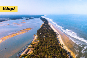
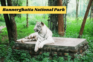
is the eighth largest state by population and is a home to a variety of wildlife

Karnataka is a state in the south western region of India. It was formed on 1 November 1956, with the passage of the States Reorganisation Act. Originally known as the State of Mysore, it was renamed Karnataka in 1973.The capital and largest city is Bangalore (Bengaluru). Karnataka is bordered by the Arabian Sea and the Laccadive Sea to the west, Goa to the northwest, Maharashtra to the north, Telangana to the northeast, Andhra Pradesh to the east, Tamil Nadu to the southeast, and Kerala to the southwest. The state covers an area of 191,976 square kilometres (74,122 sq mi), or 5.83 percent of the total geographical area of India. It is the seventh largest Indian state by area. With 61,130,704 inhabitants at the 2011 census, Karnataka is the eighth largest state by population, comprising 30 districts. Kannada, one of the classical languages of India, is the most widely spoken and official language of the state.

Area191,791 sq km
CapitalBangalore (Bengaluru)
Population61,130,704
Official LanguagesKannada
Boundary

Karnataka is bordered by the Arabian Sea and the Laccadive Sea to the west, Goa to the northwest, Maharashtra to the north, Telangana to the northeast, Andhra Pradesh to the east, Tamil Nadu to the southeast, and Kerala to the southwest.

Karnataka Has A Multi-religious And A Multi-cultural Population. Hence A Variety Of Festivals Are Held In The State. Karnataka Like Most Of Its Southern Neighbors Has Several Temples Which Also Account For A Number Of Festivals Being Held Each Year. Dusshera, The Most Important Hindu Festival Is Celebrated With Extravagance Over A Period Of Ten Days. This Festival Was Started By The Rulers Of The Vijaynagar Empire. Other Festivals Celebrated In Karnataka Are Yugadi, Karaga Celebrated At The Darmaraya Temple And Rajyotsava Day. Makara Samkramana, Sri Ramanavami, Sri Krishna Janmashtami, Ganesh Chaturthi And Deepavali Are The Other Festivals Celebrated In Karnataka Along With The Rest Of The Country. The Fairs Which Are Held In Karnataka Are Sri Vithappa Fair, The Godachi Fair, Shri Yellamma Devi Fair And Banashankari Devi Fair

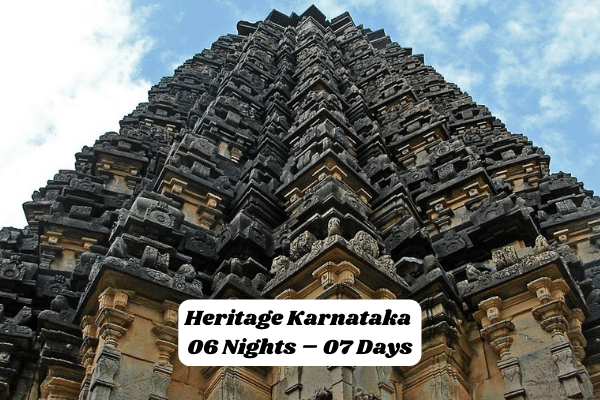
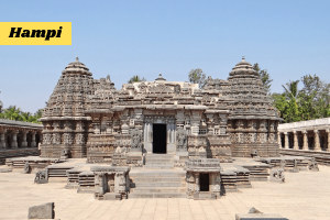
With A Strong Lineage Of Indian Emperors Ruling This State, The Culture Of Karnataka Has Been Shaped By Like Mauryas, Chalukyas The Hoysalas, And The Vijayanagar Empire. They Have Left Behind A Rich Cultural Heritage That Is Still Evident In The Everyday Life. Karnataka Is Also Home Of Various Tribes Like Kodavas, Konkanis, And Tuluvas. The Beautiful Land Has Been Blessed With Timeless Monuments, World Heritage Sites, Luscious Green Forest, Marvelous Wildlife, Romantic Hill Stations, Stunning Beaches And Vibrant Culture That Resonates It All. The Diversity It Offers In Terms Of The Language, Arts, Crafts And Festivals Is Astounding. The Royal Patronage Of The Vijaynagar Empire Has Left A Long Vivacious History And Illustrious Landmarks That Has Led To Them Being Declared As World Heritage Sites. The ‘art’ And ‘craft’ Work Of Karnataka Is Evident In Every Sphere Of Our Daily Lives. Read On To Find Out More About This Rich Cultural Land.

  • The Cuisine Of Karnataka Includes Many Vegetarian And Non-vegetarian Cuisines. The Kannada Cuisine Is One Of The Oldest Surviving Cuisines And Traces Its Origin To Iron Age – Ragi And Is Mentioned In The Historical Works By Pampa Maha Kavi, Sushrutha, Etc. The Varieties Of The Karnataka Cuisine Has Influenced The Neighbouring States Like Tamil Nadu, Andhra Pradesh, Kerala And Maharashtra. The Cuisine Also Reflects Influences From The Food Habits Of Many Regions And Communities From The Three Neighbouring South Indian States, As Well As The State Of Maharashtra To Its North. Some Typical Dishes Include Bisi Bele Bath, Jolada Rotti, Chapati, Ragi Rotti, Akki Rotti, Saaru, Idli-vada Sambar, Vangi Bath, Khara Bath, Kesari Bath, Benne Dose, Neer Dose, Ragi Mudde, Paddu/ Gundponglu, Koli Saaru (chicken Curry- Kannada Style), Maamsa Saaru (mutton Curry – Kannada Style), And Uppittu. The Famous Masala Dose Traces Its Origin To Udupi Cuisine. Plain And Rave Idli, Mysore Masala Dosa And Maddur Vade Are Popular In South Karnataka. Kodagu (coorg) District Is Famous For Spicy Varieties Of Pork Curries While Coastal Karnataka Boasts Of Many Tasty Seafood Specialities. Among Sweets, Mysore Pak, Holige, Or, Obbattu, Dharwad Pedha, Chiroti, Sajjige, Kadabu/ Karjikaayi Are Well Known.

    Although The Ingredients Differ From One Region To Another, A Typical Kannadiga Oota (kannadiga Meal) Includes The Following Dishes In The Order Specified And Is Served On A Banana Leaf: Uppu (salt), Kosambari, Pickle, Palya, Gojju, Raita, Dessert, Thovve, Chitranna, Rice And Ghee.

    After Serving Ghee To Everyone, One May Start The Meal. This Is Done To Ensure That Everyone Seated Has Been Served All The Dishes Completely.

    Obbattu ( Holige ) Fenugreek Akki Rotti With Ghee And Peanut Coconut Chutney

    What Follows Next Is A Series Of Soup Like Dishes Such As Saaru, Muddipalya, Majjige Huli Or Kootu Which Is Eaten With Hot Rice. Gojju Or Raita Is Served Next; Two Or Three Desserts Are Served; Fried Dishes Such As Aambode Or Bonda Are Served Next. The Meal Ends With A Serving Of Curd Rice.

    There Is Some Diversity In Core Food Habits Of North And South Karnataka. While Northern-style Dishes Have Jola And Rice As The Primary Cereals The South Uses Ragi And Rice.

The Beautiful State Of Karnataka Is Dotted With Numerous Monuments And Heritage Properties Which Signify That It Has Been A Place Of Royal Families And Kings. The Royalty Of Karnataka And Its Rich Culture Can Further Be Observed In The Forms Of Its Rich Art And Crafts. The Art Of Making Crafts In Karnataka Has Passed From Generation To Another Thus Making It More Like A Tradition. Almost Every Region In Karnataka Is Renowned For Some Kind Of Exclusive Crafts Like Mysore Is Well Known For Its Paintings And Silk While Udipi Is Famous For Its Metal Works. Important Of Handicrafts Arts And Crafts In Karnataka Have Always Been An Inseparable Element From The Life Of Its Native People. Since Ancient Time, The State Of Karnataka Has Gained Immense Popularity For Its Crafts And Is Still Today Occupies An Imperative Position With Respect To Art And Crafts. One Of The Major Factors That Distinguish The Crafts Of Karnataka From Others Is The Significant Reliance Of People On Traditional Method Of Producing Crafts. In The Recent Years, The Government Has Also Come Up To Support And Encourage Traditional Art And Craft And Thus Many People Now Are Associating Their Self With Crafts Making. Wood Works Wood Works In Karnataka Is An Ancient And A Popular Craft Of The State That Has Evolve For Many Centuries. The Most Impressive Wood Work Or Carvings Can Be Seen In The Temple That Adorns The Charm And Grandeur Of Karnataka. The Exquisite Carvings Done On The Wooden Doors And Ceiling Are Indeed Remarkable And Deserves Great Appreciation. Idols Of Gods Carved Out Of Wood Are Most Common In The State That Can Be Seen In Almost All Household. Sandalwood That Are Used To Produce Beautiful Art Pieces Like Lamp Shades, Decorative Articles, Images Of Lord Krishna Are Very Popular Crafts That Allures Every Tourist To The State. Mysore Silk Silk Is Considered As The Major Export Material Of Karnataka. Mysore Is Often Accredited As The Main Hub For Producing Mulberry Silk In The State. Production Of Mulberry Silk In Mysore Is Not New Rather It Is Said That This Enchanting Destination Was Known For Silk Since The Reign Of Tipu Sultan. Numerous Items Are Made From The Silk Like Silk Sari And Silk Shawls Which Are Quite A Popular Products Among The Female Travellers In The State. Metal Ware Metal Work In Karnataka Is Performed Across Its Different Parts. Some Of The Places In The State Are Well Known For Brass Casting While Others Have Gained Immense Reputation For Metal Works. Numerous Religious Articles Are Made From Metals. Udipi Is Regarded As The Hub Of Metal Works In The State While Mangalore Is Famous For Its Bell Metal And Nagamangala For Its Bronze Casting. Mysore Paintings One Of The Oldest Forms Of Art That Has Passed From Generation To Another Is Probably The Mysore Paintings. It Is Often Claimed That The Art Of Paintings Initiated In Mysore Way Back During The Ajanta Period. Vijayanagara Dynasty Is Recognised As To Have Significant Contribution In The Flourishing Of Paintings Arts In The State. Even Today, Paintings In Mysore Are Made Using Traditional Methods That Involves Extensive Use Of Lustrous Gold Leaf And Bright Colours Making Its Unique And Exquisite. Ivory And Stone Carving The State Of Karnataka Is Also Earned Immense Reputation For Its Ivory Carvings Across The World. Ivory Carvings Are Delicately Performed To Create Figures Of Deities. Similarly Stone Carvings In The State Are Also Considered As Another Popular Craft. The Skills Of Craftsmanship Related To Stone Carvings Can Be Widely Seen In Temples And Idols.

The twin cities of Hubli-Dharwad are located at a distance of around 430 kms from Bangalore- the capital of Karnataka state. The climate is hot and wet during the summer and rainy seasons and pleasant during winter. The twin cities have a history behind them dating back to the Hoysala period. Dharwad is the administrative capital of the Dharwad district and Hubli serves as the commerce center. Dharwad is a quiet, pleasant, and fast growing city in the northern part of Karnataka. Together with Hubli , which is a city twenty-two kilometers away, Dharwad forms a twin city.
 
Dharwad is known for its prestigious educational institutions. It houses the Karnataka University, which caters to graduate and research students. Karnataka College offers educational services to students just out of high school who aspire to make a career either in the arts or the sciences. S.D.M. Engineering College a more recent addition to the list of educational institutions offers education in Engineering. Hubli has an Engineering college (B.V.B College of Engineering and Technology), the Karnataka Medical College and other institutions.
 
Dharwad is perhaps best known for its “Pedhas”, a sweet made out of milk, and is a must-buy for any tourist visiting the city. Today, Dharwad has grown beyond its borders, with industries dotting both its northern and southern boundaries. In years ahead, it promises to be a beehive of commercial activity. The location of the city on the NH4 makes it equidistant from 2 of the most industrialised centers in the country – Bangalore, the capital of Karnataka state and Pune the 2nd most industrialised city in Maharshtra.
 
General Information
 
Population : 730,000
Temperature : Max- 39 degree C, Min- 16 degree C
Rainfall : 935 mm

Telephone Access code : ++91 836

Access
 
Air – The airport is 8km from the center of town. Air Deccan operates flights from Hubli connecting to Bangalore.
 
Rail – Hubli is a major rail junction on the Mumbai to Banglore route and for trains to Bijapur and Hospet. If you are heading for Goa the No 237 Gadag to Miraj Link Express at 8.30 pm has a 2nd class three tier sleeping coach and another combined 1st and 2nd class two tier sleeping coach attached to the train, and these go all the way to Vasco Da Gama, thus avoiding the need to change at Londa. At Londa these coaches are detached from 237 and addded to the 7806 Miraj to Vasco Gomantak Express at about 3.30am
 

Bus – There are regular buses to Bangalore (9 hr) and Hospet (4 hr). KSRTC (five daily) and Goa Kadamba bus company buses go to Goa daily. There are also buses to Mumbai (15 hr), Mangalore (10 hr), Jog Falls, Gokarna, Mysore (10 hr), and Bijapur. Across from the bus stand are private bus companies offering deluxe buses to Goa, Bangalore, Pune, Mangalore, Mumbai, and Bijapur. Hubli has a large and busy bus station. Buses to Panaji take 11 hours and leave 3 times a day.

Places of Interest
 
Someshwara Temple :  is one of the oldest temples just outskirts of Dharwad built in 12th century by Chalukyas, near SDM college.The temple has statues of Mahisha Mardini , Chaturbhuja Ganapati.Da Ra Bendre in one of poems said “Banthanna sanna somavara kanabekanna Someshwara “. River Shalmala takes birth near by but she flows under ground. Someshwara is a beautiful place with surrounding hills and trees and pond.
 
Murugha Math : This is situated on Savadatti Road. The great Sant Mrityunjaya who was the head the math, fed hundreds of students who came from villages to study at schools and colleges of Dharwad. Lord Mahantappa passed away in 1994 and now lord Shivayogiappa has taken over the deeksha of the math. Every Monday there will be lectures / music conducted in the premises of the math.
 
Shankara – Matha is located near JSS college off of NH4. Its architecture is new comprising tiles and ceramic statues, grass lawns. It has big peaceful meditation hall, between the two “gopuras” as you can see in the picture.
 
Dattatreya Temple : The God with four heads representing 4 vedas.Usually called as Dattana Gidu,Situated in Gandhi Chawk.
 
The Vittal Mandir : Also known as “Vithoba devara gudi”. Constructed in 1796 by the Maratha rulers.
 
Vanavasi Rama Mandira : It is Temple of famous God Sri Rama Along with Sita,Laxmana & Hanuman, Situatated in Malamaddi.
 
Temple of Milaralinga : This temple is situated behind J.S.S College. It is one of famous temple in Dharwad built in 12th century. The building was built in style of Chalukya”s architecture. However its been renovated. There is a saying that long ago Adilshahi”s converted it as a mosque and again Pashwe”s reconverted as Temple (The Persian stone writing, which said so is missing now). Is also called as “Milaralinga Gudda” because it”s up on Hill. Out side of this temple there is a damaged Chlukya”s “Shivalinga”. Inside the temple there are beautifully carved stone pillars and “garbha gudi” has idol of Chaturbhuja (having four arms) Milara holding Dhamaru, Trishul, Khadga and Kapala. Besides this idol there are sculptures of dog, Horse etc. At the center of four pillars, there is a statue of Nandi and roof has beautiful designs of lotus (Kamala). The statue of temple is so situated that first sunrays touch the statue, before daylight breaks over rest of Dharwad. There are Dargas right infront of temple, Peer Anwarsha and Moonawarsha , and every year in the month of Rajjab , Urus takes place.
 
Ulavi Basappana temple : Chennabasavanna and his team (disciples of Lord Basaveshwara) fled from the hostile Kalyana. On their way to the forests of ulavi they rested here. It is a big stone temple with 63 mantaps constructed by the saints of Shaiva cult. A Mela (Jatri) in August every year (Shravana Masa) celebrates the occasion. A group of people wearing colorful dresses dance in the streets of Dharwad every Monday during “Shravana Masa”
 
Ganapati Temple : A small temple of Ganapati or Vighneshwara situated in KCD circle
 
Durgadevi Temple : A temple of the Goddess Durga. Situated near the Corporation building. There is a heavy round stone in the temple. A belief among young svhool going kids “if you lift the stone and place it back without making sound, you will pass in the exam”.
 
Tapovan : This is the temple near the University. A great learned Saint called Kumaraswami established it. People from all over the country came here to listen to his lectures. Since his death last year his followers are maintaining it. Formarly this math was called Navakalyana math in the city and then it got shifted to Tapovan.
 
Renuka (Yellamma) Devi-Temple : This is a well-known temple in North Karnataka visited by pilgrims mainly from Karnataka, Maharashtra & AndhraPradesh. Yellamma temple is situated atop hill, near Soundatti in Belgaum district. The number of devotees visiting the temple is estimated to be around 30 lakhs, their number is the highest on Bharat Hunnime day. Several other famous temples situated at this holy place include Sri Jamadhagnishwar Temple, Sri Parashuram Temple, Yekhanath Joghinath temple, Ganesh temple & Sri Aanjaneya temple.
 
The major churches : The Roman Catholic Church St Joseph near Jubilee circle, The Basel Mission Church – Near Laxmi talkies
 
Mosque : The Jumma Mosque in Dharwad is main Mosque for followers of Islam in Dharwad. There are many mosques in Dharwad, Hubli and also all around Dharwad District. They all have big, tall minors and dome in the center. There are Dargas right infront of Mailaralinga temple, on Vidyagiri hill, Peer Anwarsha and Moonawarsha ,and every year in the month of Rajjab , Uruus takes place.
Weather forecast :
Scattered showers. There is a 30% chance of precipitation. Cloudy. Temperature of 34°C. Winds NW 18km/h. Humidity will be 56% with a dewpoint of 24° and feels-like temperature of 41°C.
 
HOW TO REACH HERE
 
By Air
The nearest airport to Hospet is in Tornagallu which is at a distance of 33 Km. Tornagallu is one of the most importnat airports in Karnataka and is served by service of Air Deccan. From the airport you can hire a taxi to Hospet. It will take around 1 hour to cover the distance. There are KSRTC buses as well that ply between these cities.
 
By Rail
There is a railway station in Hospet itself. It is connected with regular trains from Bangalore, Mysore, Hyderabad and Hubli. Railway station is situated close to the city center.
 
By Road
Hospet is well connected to all the major cities of Karnataka. Transport buses from the capital city Bangalore are regular to Hospet. Bangalore is around 350 Km from here. Hampi is among the most important travel destination in Karnataka which is only 13 km from here. Hospet thus is the best place from where you can visit to Hampi.
Hospet was once the stronghold of the mighty Vijayanagar Empire while Hampi was the capital of the Vijayanagar Empire. Most of the remains of the Vijayanagar Empire are accumulated in the places near Hampi and Hospet. And Hospet is the perfect center for the visitors of Hampi. It is just 13 km away from Hampi and it is also known as the gateway to Hampi. The findings from the excavation of Hospet reveal the involvement of Hospet in the history of Karnataka.
 
Sight see
 
About Tungabhadra Dam :
                  Tungabhadra Dam, set up across river Tungabhadra, is one of the chief attractions of the town of Hospet. The multi-purpose reservoir was built by Dr. Thirumalai Iyengar, an engineer from Chennai. The dam has a storage capacity of 135 thousand million cubic feet.
The dam gets filled with water during rains and water is supplied to the canals. It fulfils requirements of electricity, irrigation of land as well as prevents natural disasters like floods. Over the years, the site of the reservoir has become a popular picnic or tourist spot.
                   Besides, the water body has various species of fish and other aquatic animals. Species such as greater flamingos, spot-billed pelicans, storks and others can also be spotted at the site. Tourists visit in large numbers to the artificial water body to spot movements of birds and fishing.
 
About Queen\`s Bath :
                Queen`s Bath, one of the famous historic testimonies, is constructed over a large area. Enveloped between gallery, verandas and overhanging Rajasthani balconies, the bath of yesteryears sprawls over an area of 15 m. The ancient testament is also known as the Stepped Bath, as it features steps leading to the water body for bathing.
During olden times, there was a waterfall in the complex that poured cool and perfumed water through an underground drain. At present, these structures have scattered, some in adequate condition, while others in ruins. However, the architecture marvel still depicts creativity and craftsmanship of the artisans.
 
About Vittala Temple :
                  Vittala Temple is one of the most frequented sites of the region. The ornate of 16th century is positioned on the southern bank of Tungabhadra River. This shrine is dedicated to Lord Vittala, a deity in Pandharpur.
One of the highlighting features of the temple is the fifty-six musical pillars, that produce a sound when struck. The temple houses beautiful sculptures of Varaha, one of the manifestations of Lord Vishnu. A stone chariot for Garuda, a carrier of Lord Vishnu, at front of the temple grabs attention of the tourists.
Pillars of the shrine are ornamented with depictions of Narasimha. The construction of shrine began in 1513 but the temple was destroyed in 1565 before its completion.
 
About The Archaeological Museum :
                     The Archaeological Museum features archaeologically significant artefacts and items. Positioned in a small hamlet of Kamalapuram inBellary, the gallery of the museum displays numerous ancient sculptures and scale-models of the city.
These ruins and collection of sculptures were earlier housed at elephant stables by the British Officers. All the artefacts and antiquities were shifted to this building in 1972. The museum features four galleries that enclose Hampi valley with a corridor all around.
The first gallery exhibits collection of sculptures of the Saiva faith, which include Bhairava, Bhikshatanamurti, Ganesha, Kartikeya, Mahishasuramardini, Shakti and Virabhadra with his consorts and Durga. In the central hall, Shivalinga, Nandi and Dwaramantapa with a royal couple at front are displayed.
Arms, armoury, copper plate grants and metal objects of religious significance and brass plates are displayed in the second gallery. On the other hand, the 3rd gallery displays currency coins in various denominations of gold and copper, prevalent during Vijayanagara dynasty.
Antiquities pertaining to various eras, such as prehistoric, protohistoric period, medieval along with sati stones are displayed in the fourth gallery. The excavation items such as stucco figurines, Iron objects and sherds of porcelain are also put on display.
 
About Hazara Rama Temple :
                    Hazara Rama Temple, positioned along the main road to Hampi, is one of the prominent sightseeing spots of Hospet. In yesteryears, the temple was the private place for the worship of royal family.
The 15th century temple was originally known as Hajana Rama, meaning the palace temple. Dedicated to Lord Rama in olden time, the shrine still displays beautiful carvings from the Ramayana. At present, it houses an image of Lord Buddha, who is believed to be 9th incarnation of Lord Vishnu.
 
About Raghunath Temple :
                  Raghunath Temple is a major sightseeing location, owing to its religious and historic significance. Dedicated to Lord Rama, the shrine features images of deity carved on the boulder.
According to Hindu Mythology, Lord Rama along with his brother Lakshmana sheltered themselves at the site during monsoon season on their way to Lanka. The temple is built within the boulder, housing image of Ram, Lakshmana, Sita and Hanuman.
One of the highlights of the shrine is whitewashed pillars at the centre of the complex. Besides, there is a colonnade standing along enclosure in front of temple compound.
There is a sub-shrine of the goddess at the northern side of the main shrine. While on the south, there is a natural well with image of Krishna carved on the inner wall.
 
About Virupaksha Temple
                    Virupaksha Temple, one of the most significant shrines at Hampi, is dedicated to Lord Shiva. The temple is a part of a UNESCO World Heritage Site.
Virupaksha, a manifestation of Lord Shiva, is housed in the temple along with regional goddess Pampa, associated with the Tungabhadra River. Believed to be built in 7th century, there are several inscriptions carved in the temple that date back to 8th and 9th century.
There were several additions during Chalukyan and Hoysala period in the temple. The shrine comprises a sanctum, three ante chambers, a pillared hall and an open pillared hall. Entrance gates, courtyards and a pillared cloister grab the attention of the tourists.
The historic marvel is a part of the Hampi Bazaar area, which is positioned at an elevated platform of 50 m from the ground.
 
About King`s Balance :
                    King’s Balance, one of the important historic sites, is situated in proximity to Vittala Temple. It is named after ancient tradition of weighing the emperor against precious metals and food that were distributed to Brahmins. There is a 5 m tall balance, which is also known as Tula Bhara or Tula Purushadana.
                    This practice was carried out during ceremonial and festive days such as solar or lunar eclipses. Three loops on top of the balance into which the balance is hanging is the major attraction. There is a carving of King along with his concerts on the wall at the site.
                Travellers can advance to the place through Kampa Bhupa’s Path behind Vittala temple.
 
About Lotus Mahal :
                Lotus Mahal is a beautiful arena, which is enclosed by Zenana near Hazara Ram Temple. The testimony was named after a carving of lotus bud on its dome. As per historians, the enclosure was the socialising area for women in the royal family during ancient era.
                One of the rare secular or non-religious structures in Hampi, it is also known as Chitragani Mahal and Kamal Mahal. The structure was made of lime mortar and brick made composition. It is a two-storey structure with an open base floor and upper floor featuring balcony and arched windows. The decoration and architectural carvings are a blend of Hindu and Islamic styles.
 
 
About Royal Palace :
                  The Royal Palace Complex is one of the major attractions of the township of Hampi, positioned at the entrance. The complex served to the royal family of Vijayanagara Empire during yesteryears.
                  Located in the southern region of Kamalapuram village, the site is also approachable from Hampi Bazaar.
Fast Fact
  • Area : 
    26 sq km
  • Temperature : Summer: 41- 37 C Winter: 27 – 24 C
  • Rainfall : 57.2 cm
  • Best season : October to March
  • STD Code : 08394
Getting There
AIR
The nearest airport is Hubli (151 km) which is connected by Air Deccan flights with Bangalore.
 
RAIL
The nearest railhead Hospet (13 km) is connected by rail with Bangalore, Hubli and Guntakal.
 
ROAD
Hampi is connected by road with:
Aihole 156 km
Badami 180 km
Bangalore 325 km
Bellary 74 km
Belgaum 259 km
Bidar 379 km
Bijapur 248 km
Chitradurga 151 km
Dharwad 181 km
Gadag 98 km
Gulbarga 264 km
Guntakal 133 km
Hassan 353 km
Hospet 13 km
Hubli 151 km
Mangalore 404 km
Mysore 491 km
Panaji 325 km
Pattadakal 173 km
 
          Vijayanagara, the “City of Victory,” was one of the greatest of all medieval Hindu capitals of South India. Its impressive ruins in central Karnataka are known best as Hampi, after the name of a still populated local village. Traditionally known as Pampakshetra of Kishkindha, Hampi is situated on the southern bank of the river Tungabhadra.
It was the seat of the mighty Vijayanagara Empire (1336-1565) which extended from the Arabian Sea to the Bay of Bengal and from the Deccan Plateau to the tip of the Indian Peninsula. Hampi is a UNESCO World Heritage Site.
 
Sights to See :–
             The monuments of Vijayanagara city, also known as Vidyanagara in honour of the sage Vidyaranya or Madhava, were built between AD 1336-1570, from the times of Harihara-I to Sadasiva Raya. Deriving inspiration from the sage, Harihara and Bukka, two of the five sons of Sangama, founded the kingdom of Vijayanagara, in 1336 AD. They named it after him and made Pampapati or Virupaksha their patron deity. A large number of the royal buildings were built by Krishnadeva Raya (AD 1509-30), the greatest ruler of the dynasty. The period witnessed resurgence of Hindu religion, art and architecture on an unprecedented scale. Chroniclers who came from far off countries-such as Arabia, Italy, Portugal and Russia visited the empire and left graphic and glowing accounts of the city. It covered an area of nearly 26 sq km and is stated to have been enclosed by seven lines of fortifications. Temples of this city are noted for their large dimensions, florid ornamentation, bold and delicate carvings, stately pillars, magnificent pavilions and a great wealth of iconographic and traditional depictions which include subjects from the Ramayana and the Mahabharata. The Krishna temple, Pattabhirama temple, Hazara Ramachandra and Chandrasekhara temple as also the Jain temples, are other examples. Majority of these temples were provided with widespread bazaars flanked on either side by storeyed mandapas. Open from sunrise to sunset.
 
Museum:
              There is an Archaeological Survey of India Museum in Kamlapur (3 km). Tel: 08394-241561. Timings: 1000-1700 hrs. Closed on Fridays. Entry Fee Rs. 5, Entry is free for children up to 15 yrs.
 
Achyuta Raya Temple ;
             Chakrathirtha ; Kodandarama Temple
 
Krishnaswamy Temple:
           Inaugurated in 1513 AD with the installation of a Bala Krishna idol
 
Zanana Enclosure:
          About ½ km to the northeast of the Hazara Rama Temple. Within an irregular rectangular wall, are the remains of three palaces, three watch-towers, a pond, a store and a double-storeyed mahal. Entrance Fee: For Zanana Enclosure and Vitthala Temple Complex: Citizens of India-Rs. 10 per head, Others: US $ 5 or Indians Rs. 250 per head, Children up to 15 years free.
 
King’s Palace:
          This is the largest enclosure including two major platform structures, an underground chamber which must have served as a treasury or private audience hall, several other platforms, double fortification walls and several interesting architectural elements.
 
Mahanavami Dibba:
           Equally Impressive is the massive Mahanavami Dibba, where the king once sat on gem-studded golden thrones and watched processions passing by. The platform sports densely carved bands of horse, soldiers and depictions of the various aspects of courtly life.
 
Queen’s Bath:
           This structure has a very plain exterior but the interior is stunningly ornate with graceful arched corridors, projecting balconies, and lotus shaped fountains that used to spout perfumed water for ladies of the court.
 
Lotus Mahal:
             This visually appealing structure has two levels, with open pavilions at the bottom and balconies above. An elegant example of the fusion of the Hindu and Muslim style of architecture, the Mahal derives its name from its beautiful, geometrically arranged cusped arches that resemble the petals of lotus flower opening to the sun.
 
Elephant Stables:
              An imposing edifice with arched entrance and many domes that once housed the magnificent state elephants.
 
Pattabhirama temple:
                East of Kamlapura. It is one of the most impressive of all the 16th century temples. The towered gateway is complete in all its ascending storeys.
 
Pushkarani:
           The stepped water tank excavated in the mid-1980s was originally a part of the palace complex. Almost lyrical in its beauty, the tank is a tiered structure crafted from rectangular pieces of granite.
 
Hazara Rama Temple:
               This was a royal temple reserved for ceremonial use. The entire temple is embellished with bas-reliefs depicting the scenes from the epic Ramanayana. The walls are richly carved with friezes depicting processions of horses, elephants, dancing girls and soldiers attired in splendid weaponry. Inside, four exquisitely sculpted granite pillars add to the beauty of ardha mantapa.
 
Vittala Temple :
           Vithala Temple is Hampi`s crowning glory, with a magnificent stone chariot standing in the temple courtyard. Equally impressive is the large ‘Rangamantapa’ with 56 musical pillars.
 
Virupaksha Temple:
              Dedicated to Lord Shiva and his consort Padmadevi, this is the only temple that is still used for worship. Parts of the temple predate the Vijayanagar Empire. The temple’s nine storied gopuram towers above the other structures at Hampi. The ceiling of the ‘Rangamantapa’ is beautifully painted with scenes from the Puranas. Entry fees: Rs. 2, Camera: Rs. 50, Video Rs. 500.
 
Lakshminarasimha:
               The awesome 6.7 m monolith depicting the man-lion form of Vishnu is seated on a seven-hooded serpent.
 
Badavilinga:
             Located next to the Lakshminarasimha statue, it is 3 m high and stands permanently in water that flows through an ancient channel.
 
Ganesha images:
             Two Ganesha images (Sasuvekalu and Kadalekalu) can be seen on the slopes of Hemakuta Hill. One of them is enclosed in a temple with unusually tall pillars, while the other is in an
open hall.
The District Headquarters, Belgaum is a picture of contrasts. On one side is the old town area where the cotton and silk weavers still create magic with their fingers , and on the other the modern, bustling, tree-lined Cantonment built by the British.
 
Belgaum is one of the fastest growing cities in the northwest part of Karnataka. The district of Belgaum borders two states, Maharashta and Goa. Belgaum is accessible via air from Bombay and Bangalore. It is about 100 km (by road) from Hubli, which is one of the bigger junctions on the South-Central Railway. Belgaum is also connected by rail (single line).
 
Belgaum has several large industries; important among them is the INDAL Aluminium Factory. Belgaum is famous for the sweets and locally made ice cream. Belgaum is also home to several divisions of the Indian Armed Forces. The Maratha Light Infantry has its regimental headquarters in Belgaum. The Commando School of the Indian Army is also situated in Belgaum. The Indian Air Force has a big airbase near Belgaum.
 
Belgaum, ancient `Venugrama` (`Bamboo village`) was the capital of the Rattas who shifted to this place from Saundatti during the close of 12th century. The place has a fort inside which there is the famous Kamalabasti built in 1204. It has a fine huge protruding lotus (Kamala) in its ceiling and this beautiful structure in Chalukyan style houses Neminatha Teerthankara image. Inside the fort is another excellent structure, the Safa Mosque with three entrances decorated with floral and calligraphic designs. Two of its pillars have Kannada inscriptions in Nagari scripts, one of 1199 of Ratta King Kartaveerya IV and another of 1261 of Sevuna (Yadava) Krishna.
 
A few other landmarks in Belgaum are: The St. Mary`s Chruch built in 1869, the Maruthi temple believed to be of Chalukyan times, the Kapileshwar temple also of Chalukyan times.
 
Access
 
Air : Belgaum has an airport.
 
Rail : Belgaum is connected by rail to Bangalore (via Londa), Mumbai (via Miraj), Vasco da Gama.
 
Road : Belgaum is connected by road to most places in south and west of India.

Places of Interest
 
In the heart of Belgaum, near the bus terminus is the Fort. At the entrance are two shrines. One devoted to Ganapathi and another to Durga. Inside the fort are two Bastis in the late Chalukyan style. Of these, the more famous is the Kamala Basti, built in 1204. Come out of the Kamala Basti and you will find another ruined Jain Temple to its right. Co-existing harmoniously with these examples are two ancient mosques- the Safa Masjid and the Jamia Masjid.
 
Near the 16th century Jamia Masjid is a dargah of Khanjar Wali.
 
Kittur – No story of Belgaum is complete without a mention of Kittur Rani Chennamma. One of India`s first freedom fighters, the queen`s heroic resistance is still commemorated locally,in song and story. Her statue stands sentinel over Belgaum at a prominent square.
 
The Kapileshwara Temple – The Kapileshwara Temple said to be the oldest, the Ananthashayana Temple, the Maruti Temple and the temples of Shiva,Vithoba,Dyamavva and Military Mahadeva.
 
The Different Churches of Belgaum – Belgaum also has some very impressive churches. St. Mary`s Church, St. Xavier`s Church (the oldest), St. Anthony`s Church, the Cathedral of our Lady and the Methodist church.
 
Another historical site is the Pampa Sarovara. Built specially for the 1924 All India Congress Session, which was presided by Mahatma Gandhi. Belgaum also has some well laid out parks. The Sambhaji Udyan, the Nath Pai Park and the Shivaji Udyan. Perfect places to relax, to put your feet up and let your imagination soar free.
 
Gokak Falls – Gokak Falls is 60 kms from Belgaum and 5 kms from Gokak town. The Ghataprabha River takes a leap over a rocky bed 170 feet down. The best season for visiting thiese Falls is between June and September.
Abour Karwar :
 
519 kms north-west of Bangalore is Karwar. The district headquarters of Uttara Kannada, this is an ideal place to relax. Karwar has sacred pilgrim centers, historical towns and some of the most beautiful beaches in the country. It is said to have inspired Tagore to pen his first drama. The Devbagh Beach, is a must for beach lovers.
 
Excursions (Distances and directions from Karwar)
 
Gokarna
60 kms south of Karwar, this coastal town has, among other things, an ancient temple with the Atmalinga. Gokarna is also a famous center for Sanskrit learning. The Om Beach and the Kutle Beach nearby, are also worth a visit. 
60 kms from here is Yana – a deserted township with unique rock formations. Yana is also a popular rock climber`s haunt.
 
Bhatkal
135 kms south, is a historical township: The ancient port town has temples of Vijayanagar times and many interesting Jain monuments. 16 kms away is the scenic holy place of Murdeshwar. The temple here attracts a lot of devotees and tourists. The Pigeon Island is off the Murdeshwar coast. The beaches at Gokarna, Bhatkal and Murdeshwar are undiscovered and thankfully unspoiled. 
 
Banavasi
140 kms from Karwar, is a temple town mentioned in the Hindu epics, the Ramayana and the Mahabharata. 
 
Shivganga Falls
140 kms away, amidst scenic surroundings, the River Souda falls into a deep valley from a height of 74 m to form the falls. 
 
Dandeli 
93 kms from Karwar, is a popular holiday resort. The wildlife sanctuary here abounds with a variety of rare animals. The cave with Shivalinga-like laterite formations is also well worth a visit. 
 
Magod Falls 
A few kms from Karwar, is a scenic delight. The Bedti River plunges into a 180 m rocky valley in two leaps. 
 
Lalguli Falls 
Itis a picturesque waterfall formed by the river Kali. 
The Mailmane Falls also deserve a visit. 
 
How To Reach :
 
By Air 
The nearest air link from Karwar is provided by the Dabolim Airport of Goa, situated approximately 90 km away. It is well connected with all the major cities of India, such as Bangalore, Mumbai, Chennai and Delhi, by direct and regular flights. Indian Airlines and Jet Airways are amongst the major airlines that serve the airport. From here, you can take a taxi or a bus to Karwar, with the former costing around Rs 1,500.
 
By Rail 
Karwar has a railways station of its own, situated about 2 km away from the main town. A major station on Konkan railways, it has a number of important trains, such as Matsyagandha and the Netravati Express, making a stoppage. From the station, you will easily get an auto rickshaw for going inside the town.
 
By Road 
Karwar is situated at a distance of 105 km from Panaji (Goa), 298 km from Mangalore, and 513 km from Bangalore. It boasts of a good road network, which connects it with all the major cities of Karnataka as well as the neighboring states. There regular KSRTC buses from Karwar to the nearby cities. In case you want to drive to the place, from Bangalore, take NH4 to Tumkur and then NH206 towards Shimoga. After Bhadravathi, head towards Honavar, via Sagar and from there, take NH17 for reaching Karwar
 
When To Visit :
            October to May 
 
Temperature:
 
Min Temperature: 22 degree C (Summer), 10 degree C (Winter)
Max Temperature: 40 degree C (Summer), 32 degree C (Winter)
 
About Magod Falls :
 
Magod falls is about 80 kms from Karwar. River Bedti gushes down in two leaps offering a beautiful view and the wooded area offers an ideal picnic spot. The beautiful falls amidst dense growth of evergreen forests plummets down into a rocky ravine from a height of 650 ft.
 
Magod falls can be reached by road comfortably in sturdy vehicles, keeping in mind the mountainous terrains required to traverse. It is about 19 km from Yellapur and 60 km from Kumta.
 
On the way to this waterfall you will find nice lake called “Kavade Kere” of about 60acres area. Trip to Magod falls in Yellapur taluq in North Kanara district in North West Karnataka will also be an opportune moment to visit the nearby sites like Jenukallugudda (honey rock hillock) where you can watch the mesmerizing sunset and Kavadikere (8km from Yellapur), a beautiful large lake.
 
How to Reach:
 
Nearest Railway Station: Yellapur
 
Nearest Airport: Goa Dabolim Airport
 
By Road: From Bangalore 520 kms, Karwar 100 kms, Goa 205 kms, Yellapur 19 kms.
 
When To Visit :
 
The post-monsoon period between October and November is quite pleasant and considered the ideal time to visit Magod Falls.
Badami, the one time capital of the Chalukyas , is noted several temples, some structural & other rock-cut, of the 6th & 7th Centuries. The foundations of Badami, or Vatapi as it was called, were laid by Pulakeshin I (535 – 566 AD), his son Kirtivarman the Ist (567 – 598 AD), beautified the town with temples & other buildings.
 
Mangalesha (598 – 610 AD), brother of Kiritavarman I completed the construction of the cave temples & endowed the temples with the village on the occasion of the installation of the image of Vishnu. The greatest ruler of the dynasty was Pulakeshi II (610-642 AD) who among others defeated the Pallava King Mahendra Verman I. The Pallavas later captured & destroyed Badami to avenge their defeat. Badami was also in the possession of the Vijayanagar Kings, The Adil Shahis of Hyderabad, The Savanur Nawabs, The Marathas, Hyder Ali of Mysore & finally the British who made it part of the Bombay Presidency.
Access
 
Air – The nearest airport in Karnataka is Bangalore [502 Kms], Also Badami can be reached from Hyderabad via Raichur.
 
Rail – The nearest railhead is Badami (4 Kms from Badami town) on the Hubli-Sholapur line & is connected to , Bangalore, Bagalkote & Bijapur.
 
Road – Badami has convenient road connection to several important places around it. We recommend Hubli (app. 100 Kms), which has a major Railway junction apart from being one of the important cities in Karnataka. Some of these are
 
Aihole (46 Kms)
Bangalore (502 Kms)
Bagalkote (66 Kms)
Bijapur (132 Kms)
Gadag (70 Kms)
Hampi (180 Kms)
Hospet (167 Kms)
Hubli (97 Kms)
Pattadakal (27 Kms)
Panaji (284 Kms)
 
Festivals
 
Banashankari Temple Festival near Badami during January- February.
Virupaksha temple Car Festival in Pattadakal in March.
Mallikarjuna Temple Festival in Pattadakal in March-April.
Badami – Places Of Interest
 
Badami Caves – 1 km, this group of 4 cave temples have been carved out of the hill opposite Badami fort. The Chalukyan king, Mangalesa(598-610)AD)was responsible for the completion of these cave temples. Of the four, three are Brahmanical, while the fourth is Jain. Nearly 2000 steps have to be climbed to reach the cave.
 
Cave I – This is a Shaivite cave. The important carvings in this cave are an 18-armed dancing Shiva, a two-handed Ganesha, Mahishasura Mardini, Ardha Nareeshwara & Shankarnarayana. The ceiling is adorned by a serpent motif & other carved figures
 
Cave II – This cave has Vaishnavite influence with panels of Trivikrama & Bhuvaraha. On the ceilings are carvings of Anantasayana, Brahma, Vishnu, Shiva &other Ashtadikpalas.
 
Cave III – Another flight of steps takes one to the third cave, which is the largest & the best of the lot. This cave has carvings pertaining to both Shaivite & Vaishnavite themes. Panels of Trivikrama, Narasimha, Shankaranarayana, Bhuvaraha, Anantasayana & Harihara are engraved in a vigorous style. An inscription found here records the creation of the shrine by Mangalesha in 578 AD. There are some fine bracket figures on the pillars of this cave.
 
Cave IV – Lying to the east of cave three, the fourth cave is Jain. There is an image of Mahavira adorning the sanctum. Other carvings here are of Padmavathi & other Thirthankaras. Asteep climb up some steps cut in a crevice between Cave II & III leads to the southern part of Badami Fort & to an old gun placed there by Tippu Sultan.
 
Badami Fort – 2 Kms. Strategically situated on top of the hill, the fort encloses large granaries, a treasury impressive temples on top of the northern end of the hill. Malegitti Shivalaya, perhaps the oldest temple of the lot, is dedicated to the benign aspect of Shiva as the garland maker. Placed on the summit of a rocky hill, the temple is built of stone, finely joined without mortar, & with Dravidian tower. The lower Shivalaya has a Dravidian tower of which only the sanctum remains now.

There are some more temples in Badami town & several of them dotting the banks of a well-built tank locally called the Agasthya Tirtha.

Jain Temple – A number of Jain temples and a figure of Parshwanatha are the landmarks of this city as they stand atop a cliff.
 
Nataraja Temple – The eighteen-armed Nataraja striking 81 dance poses is the unique center of attraction here. Believed to be the first cave temple, it is one of its own kinds in the whole of India.
 
Vishnu Temple – The largest third cave temple dedicated to Lord Vishnu is the most ornamental temple in Badami. There are wonderful bracket figures on the piers and also some paintings on the ceiling. Some splendid carvings of the composite god who is half Shiva and half Vishnu, Hindu pantheon, such as Narasimha, the half-man-half-god lion incarnation of Vishnu, Harihara, Narayana sitting as well as reclining on the snake “Shesh” or “Anantha” (eternity) are also there.
 
Lake – The water of this lake to said to have the healing properties. A bracy dip in the serene waters of this lake is said to cure leprosy.
 
Archaeological Museum – This museum set up by the Archaeological Survey of India houses artifacts of local sculptures including the remarkable Lajja-Gauri images of fertility cult. The tourists visiting Badami can opt for comfortable and luxurious accommodation in Badami, Karnataka. The hotels in Badami give the tourists every modern facility to make their stay memorable in Badami.
 
Museum & Art Gallery – A sculpture gallery is maintained by the Archaeological Survey of India on the Bhutanatha Temple Road.
About Gokarna :
 
Gokarna, meaning Cow’s Ear, is a small village in the Uttara Kannada district of Karnataka state. Gokarna is a pilgrimage centre as well as a tourist destination. Gokarna’s is a temple town with the main deity being Lord Mahabaleshwara, a form of Hindu god Shiva.
 
There are also numerous beaches in and around the town that serves as a tourist attraction for travelers. The name of this town is based on the belief that Lord Shiva emerged from the ear of a cow (Prithvi, the mother Earth) here. Gokarna is also located at the ear shaped confluence of two rivers Gangavali and Aghanashini. Gokarna is a beautiful place with stretches of coconut and palm trees, blue seas and clean sands, traditional town look with shopping streets and tile-roofed brick houses.
 
Where is it :
 
Gokarna is a village in the Uttara Kannada district of the Karnataka state, India. It is between the Gangavali and Agnashini rivers and situated along the Karwar coast by the Arabian Sea.
 
How To Reach Gokarna :
 
By Air :
The closest airport to Gokarna is Goa approximately 160 kms away. From here you would have to take a bus or a taxi to Gokarn
 
By Rail :
Only slow passenger trains stop at Gokarna Rd train station. Otherwise several express trains stop at Ankola and Kumta stations, both about 25km from Gokarna and accessible by local bus.
 
By Bus :
Ordinary and deluxe buses ply between Bangalore and Gokarna. Regular buses also run from Mangalore, Hubli and Goa.
 
When To Visit :
 
October to February is the coolest and best time to visit Gokarna. The Shivarathri festival, normally celebrated February-March also attracts its fair share of visitors and is also a good time to be in Gokarna. 
 
Try and avoid the summer months of April and May and the monsoon months between June and August as they are not the best of times to go to the beach and swim.
About Jog Falls :
 
The Sharavathi River cascades down 292 m in four distinct falls – Raja, Rani, Rover and Rocket – at Gerusoppa and is a roaring treat to one`s eyes. While the height of the Jog Falls is quite intimidating by itself; going to the base of the waterfall and then climbing back can prove a daunting task -it will take around 20minutes to walk down to the bottom, and could easily take an hour or two to come back. 
 
Being a major attraction, the Jog Falls is well connected by road and train. You can take bus or train to nearest town – Sagar and travel on local buses to Jog. If you are driving, the entire stretch of road is to be covered on a national highway which is mostly in good condition. It takes 7 to 8 hours to reach Jog Falls. A turn to the left into NH 206 in Tumkur from Tumkur road (NH 4) from Bangalore via Shimoga and Sagar towns will get you to the Jog Falls. The waterfall is just at a short 2 kms deviation from the highway. 
 
If you want to see the waterfall at its best go during or just after the monsoon. In February it looks a bit pathetic. The area around it with its many forests and the Swarna Nadi River is worth a visit though. You can spend an entire day around the waterfall. If you hike the way down to the base of the fall, taking a dip in the water when you are in the gorge will be worth tour while. A drive to the other side of the Jog Falls can get close to the falling water. The Sharavati valley, which is a little further down the national highway, affords breathtaking view. 
 
How To Reach Jog Falls
 
Air : The nearest airport is Bangalore airport 378 kms away and Mangalore (180km).
 
Rail : The nearest railway station is Shimoga (104 kms from Jog). From Shimoga one can go to Taluguppa in a train meter gauge or in a bus. From Taluguppa it is 16kms to Jog by road. There are around 4 trains daily to Shimoga from Bangalore.
 
Road :  The best approach from Bangalore is via  Tumkur road, NH 4 and then turn left at Tumkur, along the NH 206 (the condition of the road may not be good) to Shimoga and Sagara towns which have several buses to the falls each day. Now there are direct KSRTC (Karnataka State Road Transport Corporation) buses including luxury coaches from Bangalore to Jog (8.30- 9 hrs Hrs journey). One can also take a direct bus from Bangalore to Shimoga or Sagara and then take local bus from Sagara to Jog. 
 
Significance:
 
One of the highest in India and the 7th deepest waterfalls in Asia
 
Best Season :
 
August-November
About Murudeshwara :
 
Murudeshwar of Bhatkal taluk in Uttara Kannada district is around 165 km from Mangalore on the National Highway attracting lot of devotees and tourists to the place. This picturesque place situated between Honnavara and Bhatkal. Bounded by the Arabian Sea and rolling hills of Western Ghats, the place is a favorite picnic spot. Probably the finest beach, temple, restaurants, guest houses, resorts & beautiful garden in coastal karnataka and the most popular.
 
The sea is an intrinsic part of the temple scape at Murudeshwar. The sea on three sides surrounds the temple towering on the small hill called Kanduka Giri on three sides. Two life-size elephants in concrete stand guard at the steps leading to the temple. As one ascends the hillock, there is a shrine of Jattiga seated on a horse. There is a huge fort behind the temple, said to have been renovated by King Tippu sultan of Mysore. Evening visit to see sunset at sun set point is real fulfilling experience. View of small boats and fishermen coming back to their houses from quite distances and different sides in the sea make every body feel the mesmerizing evening.
 
The main attraction of Murudeshwar is Shiva temple, this sacred place presents some beautiful carvings and statues, which has a history that dates back to a few centuries (Threthayuga). The temple which embodies a Shiva Linga is believed to have erupted when Ravana (Demon King of Lanka) flung the cloth covering the Atmalinga at Gokarna while lifting it. Lord Shiva, following a complicated sequence of events, declared that Murudeshwara should be one of his five holy places.
 
Shiva Idol :
 
A recent attraction of Murudeshwara is the Lord Shiva idol erected beside the temple.
 
The idol towers 123 feet into the sky and viewable from a very long distance from the arabian sea.
 
It is the tallest Shiva idol in the world.
 
Best time to visit : 
 
Throughout the year
 
Places near Murudeshwar :
 
Bhatkal   – 16 kms
Idagunji  – 20 kms
Gokarna   – 65 kms
Karwar    – 120 kms
Kollur    – 63 kms
Jog Falls – 90 kms
Manjuguni – 90 kms
Udupi     – 100 kms
 
How to reach Murudeshwar :
 
Road: (1 km off National Highway)
 
From Mangalore: Udupi – Kundapur – Byndoor – Bhatkal – Murudeshwar
 
From Karwar: Kumata – Honnavar – Murudeshwar
 
Rail : 
       The Konkan Railways and other express trains plying on the Mangalore-Goa-Mumbai route makes a stop at                        Murudeshwar.
 
Nearest Rail-head:
 Hubli
 
Nearest Airport : 
Mangalore and Goa
In the year 1120 AD, the Chola King, Veera Ballalla ruled the Deccan plateau or the South of India. On a hunting trip in the forest he lost his way. After a long search he met an old lady in the forest who offered him shelter for the night and served him baked beans for dinner. To show his gratitude to this lady for having saved his life, the King constructed a town and named it as Benda Kalooru, which means Baked Beans. Later in 1537, a local chieftain, Kempe Gowda helped design this town and give it its modern shape.
 
Today Bangalore, the capital of Karnataka ranks as one of the fastest growing cities in Asia. Its pleasant climate, friendly people, and its highly educated population have made this the Silicon Valley of India with almost all Computer related multinationals setting up their India head office at Bangalore. Jawaharlal Nehru, India`s first Prime Minister termed this as `India`s city of the future`.
 
Bangalore is the `Garden City of India` with its many gardens and boulevards. Its pleasant climate and laid-back charm attracted many senior citizens and thus later on came to be called at `the retired man`s paradise`. And of course what is Bangalore without all its Pubs. Its is now also called the Pub City with over 200 Pubs all over the town.
Access
 
Air Network
 
Bangalore International Airport has flights to all the main cities of India and also flights to many West Asian destinations as well as London and Frankfurt.
 
Rail Network
 
Bangalore city railway station is an important destination in the Indian Railway network with trains connecting to most parts of India including the Rajdhani Express, Sampark Kranti non stop express (from Yeshwantpur) and Karnataka Express to Delhi, Shatabdi Express, Lalbag Express to Chennai, Udyan Express to Mumbai.
 
Road Network
 
Bangalore is connected to some of the major cities of India through the National
 
Highways NH4, NH7 & NH48.
 
BangaloreToTrivandrum761 Kms
BangaloreToChennai334 Kms
BangaloreToHyderabad566 Kms
BangaloreToGoa (Panaji)570 Kms
BangaloreToMumbai1033 Kms
 
Places of Interest
 
Vidhana Soudha
The State Legislative and Secretariat House was built in 1956 in the Neo Dravidian Style with granite entirely sourced from the city itself. This imposing structure represents the best of Bangalore`s monuments. Do not miss the sight of the illuminated building on Sundays between 7 and 8 PM.
 
Attara Kacheri
Directly opposite to the Vidhana Soudha is the State High court. This magnificent building was constructed in 1867 in the Gothic Style of architecture.
 
Venkatappa Art Gallery
One of the country`s oldest art museums, this gallery houses many interesting antiques and archaeological objects. (Closed on Wednesday).
 
Visvesvaraya Industrial and Technological Museum
Named after the famous Sir M. Visveswaraya , an engineer par excellence who built many famous dams in Karnataka, this Science museum houses models of machines. It is a highly recommended spot for children.(Closed on Monday).
 
Cubbon Park
Lieutenant General Sir Mark Cubbon laid out this beautiful park in 1864. Over 250 acres of this green park is just right for long walks and hosts a children`s amusement park, a doll museum and a toy train for children. Children`s parties can be arranged with cartoons characters etc. in the park. The Vijayranga Theater complex screens children`s films and stage plays.
 
Lalbagh Gardens
Bangalore`s other sprawling park is in the South of the city. HyderAli laid out the Lalbagh Gardens in the year 1760. It covers an area of 240 acres. The Glass House, inspired by the Crystal Palace in London is a favourite spot in Lalbagh which hosts the famous Flower show during the month of August.
 
Bangalore Palace
The Bangalore Palace was built in the year 1887 by the Wodeyar dynasty. It is built similar to medieval castles in Normandy and England . It`s interiors boasts of elegant woodcarvings and Tudor -style architecture.
 
Seshadri Iyer Memorial Hall
This houses the State Central Library. This place has a rich collection of reference books. Open between 0830 and 1900 all through the week except on Mondays.
 
Tipu`s Palace
The Palace was constructed first by Hyder Ali and completed by his son Tipu Sultan in the year 1791. Tipu called it as `The Envy of Heaven`. It is constructed mainly in wood and has fine intricately sculpted arches surrounded by exquisite minarets.
 
ISKCON Temple
The ISKCON provides much more for the soul, than those rituals. ISKCON are centers of spiritual learning through Godly association, where a visitor is inspired to learn more about Spiritual life. There is a magnificent main temple hall, which houses the altars of Their Lordships Sri Radha Krishna-Chandra, Sri Krishna Balarama & Sri Nitai Gouranga. Also one can see the Golden Chandelier that is shaped like an inverted Lotus Flower.
 
Fun World:
Fun World is a 12 acre Disney Land Like Amusement Park, tucked into Palace Grounds, Bangalore.
 
Shiva Statue:
It boasts of Awesome 65 feet high depiction of Lord Shiva seated in Lotus position. It has the backdrop of Mount Kailash the Lord`s heavenly abode and the river Ganga flowing from his matted locks as depicted in the mythology.
 
Bull Temple:
At Basavangudi is one of Bangalore`s oldest temples. Built for Nandi, the sacred Bull, the vehicle of Lord Shiva, this temple has a 4.6 meter tall-carved statue of the sacred bull.
 
Gandhi Bhavan:
Gandhi Bhavan displays the life of the father of the nation, Mahatma Gandhi with pictures and Photostats of his letters.
 
Aquarium:
The second largest Aquarium in the country it has a large varsity of aquatic life.( Closed on Monday).
 
Jawahar Lal Nehru Planetarium:
Befitting the `science city` title that it carries, the Planetarium is an interesting site for children. The English shows are held daily at 1630 Hrs. The Aquarium remains closed on Monday.
Fast Facts
  • Area : 121 Sq. Km
  • Temperature : Summer: 31 -26 C
Winter: 28.9-18.3C
  • Best Season : October to February
  • STD Code : 0824
 
Getting There
 
AIR
Mangalore is well connected by Air India and private airlines with major cities
 
RAIL
Mangalore is connected by rail with major cities and towns.
 
ROAD
Mangalore is well connected by road with:
Bangalore 365 km
Belur 265 km
Bidar 856 km
Bijapur 585 km
Cannanore 132 km
Chikmangaore 155 km
Hassan 180 km
Hospet 433 km
Karwar 285 km
Kollur 119 km
Madikere 139 km
Manipal 61 km
Mumbai 988 km
Mysore 265 km
Shimoga 256 km
Sringeri 130 km


The port city of Mangalore is situated at the source and confluence of two rivers :–
               Netravati and Gurpur. It derives its name from Queen Mangaladevi who is said to have lived here in the 10th century AD. Mangalore was ruled by several dynasties, including the Kadambas, Vijayanagar, Chalukyas, Rashtrakutas, and Hoysalas, followed by the Portuguese from 1498, when the Portuguese explorer Vasco da Gama landed at St Mary`s Island near Mangalore.
Eventually, the city was annexed by the British in 1799. Today, Mangalore is a major port of South India and handles over 75 percent of India`s coffee exports and the bulk of the nation`s cashew exports.
 
Sights to See :–
SrimanthiniBai Memorial Government Museum :
                Located in the Srimanthini Bhavan, it has a collection of art, archaeological and ethnological exhibits and natural history specimens. Timings: 0900 to 1700 hrs. Closed on Mondays & Wednesdays.
 
Kadri Manjunatha Temple :
             The temple on Kadri hills is dedicated to Lord Manjunatha. There is also a `Matha` here of the Jogis of the Natha Pantha.
 
Sultan`s Battery:
              This is a watch tower built by Tipu Sultan to prevent the entry of warships into the Gurpur River.
 
Mangaladevi Temple :
                A Sakti temple which gives Mangalore its name.
 
St. Aloysius Chapel :
               Built in 1885, the chapel inside the St. Aloysius College has marvellous murals covering its walls and ceilings depicting the life of Jesus Christ.
 
Kaup Beach (48 Km from Mangalore)(12 Km from Udupi) :
                South of Udupi on the coastal belt that passes through the West Coast National Highway, Kaup has a lovely beach, a ruined fort & 100 ft high lighthouse.
 
Ullal (13 Km) :
               A lovely beach just outside Mangalore, Ullal is famous for its silvery sands.
 
Surathkal (20 Km) :
               It is famous for the Sadashiva temple on top of a rocky hill on the sea shore, and also has a fine beach. An annual car festival for the deity of the temple is held in December.
 
Bajpe (25 Km) :
The Mangalore airport is located at Bajpe, which also has a waterfall.
 
Kompadavu (25 Km) :
           This small village is famous for the Nelli Theertha Somanatha Temple.
 
Mulki (29 Km) :
               Famous for the Narasimha Temple. The deity of the Janardhana Temple in Sinantur, 5 Km from Mulki, was the family deity of the Savantas. The ruins of the palace of the Savantas and the fort built by Venkatappa Nayaka of Bedmir can also be seen here.
 
Katil (30 Km) :
              On the banks of river Nandini, Katil has a temple dedicated to Durga Parameswari. The main deity of the temple is in the form of a linga.
 
Mudabidri (36 Km) :
             Mudabidri is known as the Jaina Kashi of the south. Situated in the midst of hills, there are 18 Jaina bastis here. The Jaina Matha here has rare manuscripts of `Dhavala` and `Jayadhavala` two great Jain texts.
 
Karanje (37 Km) :
The holy place of Karanje, well known for it`s Shiva temple, is situated on a hill 1,500 feet high and commands a panoramic view of the surroundings.
 
Dharmasthala (75 Km) :
             This popular pilgrim centre is an outstanding example of religious and cultural tolerance. Dharmasthala derives its sanctity from its temple dedicated to Manjunatha. The striking feature of this Shiva temple is that the priests are Madhwa Vaishnavites and the family of the Heggade who is the Dharmadikari of the place, are followers of Jainism. There is also a huge monolithic statue of Lord Gommateswara, a Jain saint here, which was installed in 1973. The Manjunatha Temple authority has boarding and lodging facilities for visitors and thousands of devotees thronging the temple are fed free of charge, irrespective of caste and creed.
 
Kollur (146 Km) :
88 Km from Udupi and 42 Km from Kundapur, Kollur is famous for the temple dedicated to Goddess Mookambiga. The image of the goddess was consecrated by Adi Shankaracharya.
 
Venur (55 Km) :
                Venur was once the capital of the Ajilas and is famous for the 9 metre high statue of Gomateswara built in 1605 and the Shantinatha Basadi
 
Karinthe (35 Km) :
This rock temple situated on top of a small hillock is dedicated to Shiva as Karintheswara.
 
Pilikula Nisarga Dham (12 Km) :
               An integrated theme park with a wide variety of features, Pilikula has many attractions of cultural, educational and scientific interest. The park is spread over an area of 370 acres comprising of a tropical forest and the enchanting Pilikula Lake. The project presently includes a Biological Park, Arboretum, a Science Centre, a Lake Park with Boating Centre, a Water Amusement Park and a Golf Course.
Udupi (60 Km) :
               Considered as one of the seven sacred spots of the region, Udupi is famous for the Krishna Temple. The Krishna idol was installed by Madhwacharya, the propounder of the Dwaitha philosophy and all the eight `mathas` founded by him, have their headquarters within the temple square. The Parayaya festival which is the most important festival of the temple is held once in two years usually in January when there is a ceremonial change of title of the head priest of the Madhwa matha.
 
Belthangady (60 Km) :
               There is an old Somanatha temple made of granite, a Venkatarama temple, a Jain Basadi with an inscription of the 15th century and a ruined fort in Belthangady;
 
Manipal (61 Km) :
               Manipal is a progressive educational and industrial centre with well known medical and engineering colleges. There is a modern Venugopalakrishna temple built in 1973 and a museum in memory of Dr. T.M.A. Pai, the architect of the township.
 
Karkala (62 Km) :
              A Jain pilgrim centre, it has a huge 42 feet tall monolithic Gomateswara statue, which was installed in 1432 AD. The beautiful granite Chaturmukha Basti, the temples of Anantasayana and Venkataramana, the old palace of the Bhairarasa Wodeyars are the other notable monuments here.
 
Malpe (63 Km) :
           Malpe has a lovely beach ideal for sun and sea bathing and boating. It is on the mouth of the Malpe or Udyavara River and has an old fort and a few temples.
 
Saint Mary`s Island (68 Km) :
                    A group of small islands lying north of Malpe port are noted for their basalt rocks which have crystalised into columns and split into hexagonal mosaic. In 1498, Vasco-da-Gama landed on these islands and called them Padron De Sante Maria. Boats are available from Malpe to St. Mary`s Island.
 
Kudremukh (102 Km) :
               Known for India`s largest iron ore project, Kudremukh is also famous for its splendid scenic beauty. The iron ore is run down through a pipeline in liquid form from Kudremukh to Mangalore harbour.
 
Maravanthe (103 Km) :
               16 Km north of Kundapur, this beautiful place has a lovely beach.
 
Kundapur (104 Km) :
             The name of the town can be traced to the Kundeswara temple built by Kundavarma, close to the Panchagangavali river. There is another temple dedicated to Mahalingeswara. The Portuguese built a fort here in the 16th century and called it Barcelore.
 
Kukke Subramanya (104 Km) :
              One of the seven sacred places in the region, Subramanya is famous for the temple dedicated to Lord Subramanya worshipped in the form of Naga (serpent). Other shrines of this temple are those of Lakshminarasimha and Umamaheswara. An annual templefestival is held in November-December.
 
Sringeri (152 Km) :
               Sringeri is famous for the `math` of Jagadguru Shankaracharya, the founder of the Advaita philosophy. The Sharadamba Temple here was founded by the Shankaracharya himself. The other places of interest in Sringeri are a Jain basadi dedicated to Parsvanatha and the beautiful Vidyashankara temple. Kigga, 8 Km from Sringeri has a temple dedicated to Rishyashringa and an old ruined fort.
 
Jog Falls (225 Km) :
                  The famous Jog Falls are about 16 Km from Talguppa, the railway terminus on the Birur line. Jog is 104 Km from Shimoga, 256 Km from Belgaum, 348 Km from Mysore and 378 Km from Bangalore. Bus services connect the Jog Falls with Bangalore, Mangalore, Bhatkal, Karwar, Hubli and Shimoga. The Gerusoppa Falls, commonly referred to as the Jog Falls are one of the highest and most beautiful in India. The falls are formed by the descent of the river Sharavathi down a chasm 256 metres deep. The water falls in four cascades namely the Raja or Monarch, Roarer, Rocket and Rani, presenting a scene of grandeur and sublimity. The Mysore Power Corporation releases water to the Jog Falls on every second sunday of the month.
 
Gokarna (227 Km) :
             Gokarna, a pilgrim centre 56 Km from Karwar is famous for the temple of Mahaballeshwara which for devotees is next in sanctity only to the Varanasi Vishwanath temple
 
Karwar (261 Km):
              Karwar, the district headquarters and port town, situated in Uttara Kannada, traces it`s history to the time of Arab traders. With a chain of five islands protecting it from storms, Karwar is famous for its beautiful stretch of sandy beaches. Places of interest in Karwar are the Sadashivgad Hill Fort with a Durga temple, the Dargah of Peer Shah Shamsuddin Kharobat-a Baghdadi saint and the Octagonal Church at Sunkeri. A visit by launch to the Kurmagad Island which has an old fort and a Narasimha shrine is an added attraction. Accommodation in Karwar is available at an Inspection Bungalow, Tourist Bungalow and Circuit House.
OOTY
 
Called the “Queen of Hill Stations” picturesque, the green Udhagamandalam, better known as Ooty is the most popular hill station in the South. Located in the Western ghats at a height of 2240m, Udhagamandalam is the headquarters of the Nilgiris district where the two ghats meet. Nature has been generous with this region, which is by far the most beautiful in the state. Apart from coffee and tea plantations, trees like conifers, eucalyptus, pine and wattle dot the hillside in Udhagamandalam and its environs. Summer temperature is rarely higher than 25°c with a minimum of 10°c and winters are distinctly cooler with a high of 21°c and a low 5°c. Curiously enough, this slice of paradise remained unknown to the great southern dynasties and it took the British to discover it in the early 1800s. They were, however, not the first inhabitants of this land as a tribe called Todas had been living there long before the British came, claiming that the Nilgiris had been their home since time immemorial. But the credit for modernising Udhagamandalam and making it accessible goes to the British who constructed the first railway line in the area and made it the summer capital of the Madras Presidency.
 
About Udhagamandalam – Settlement in Udhagamandalam began in 1822 with the construction of the Stone House by John Sullivan, the then Collector of Coimbatore. The bungalow, which is locally called Kal Bangla, is one of the landmarks of Udhagamandalam and is now the Chamber of the Principal of the Government Arts College. Not many years after the construction of the Stone House, several other English cottages with pretty gardens, large bungalows of top officials in the Government, were built. Even today the atmosphere of the Raj lingers in places like the Club where snooker was invented by a subaltern named Neville Chamberlain, the Nilgiri Library with its rare and valuable collection of books on Udhagamandalam and St.Stephen”s Church which was Udhagamandalam”s first church.
 
The cemetery near the church has the oldest British tombstones in the town and includes those of John Sullivan”s wife and daughter among other prominent personalities.
 
The Botanical Garden is maintained by the Horticulture Department of the Government of Tamil Nadu and has a very wide variety of plants that include different types of roses, imported shrubs, rare flowering plants, eucalyptus trees, several old trees and even a fossilised tree trunk that is 20 million years old. There is also a beautiful Italian floral garden and for those who simply want to relax, there”s always the green carpet of the well-maintained lawns. The “Summer Festival” is held each year during the month of May in the Botanical Garden and is an added attraction for tourists. The Flower Show is the pride of the festival. Cultural programmes are organised for those interested in traditional classical arts. Adventure spots like trekking also form part of the festival.
 
The artificial Lake, yet another of Sullivan”s contributions, has facilities for boating and permission to fish can be obtained from the office of the Assistant Director of Fisheries.
 
Among the viewpoints around Udhagamandalam are Elk Hill, Green Valley View and Snowden Peak but the most prominent is the Dodabetta Peak, which is the highest point in the district at a height of 2623m. Provided the day is clear, one can see as far as the plains of Coimbatore and the Mysore plateau.
 
Also for the nature lover are the sprawling 20,000 acres of Wenlock Downs, which was once the scene of the famous Udhagamandalam Hunt. The Gymkhana Club, the factory of the Hindustan Photo Films Company, the Government Sheep Farm and the Golf Course are all in Wenlock Downs. The Government Museum, Mysore Road, Udhagamandalam has tribal objects d”art, district”s ecological details and representative sculptural arts and crafts of Tamilnadu.
 
COONOOR: Situated at an altitude of 2000 ft and only 17 kms from Udhagamandalam is the first of three hill stations. Coonoor is a small town with an equable climate that has made it popular as a hill resort in its own right. The main attraction is the Sim”s Park, a small well-maintained botanical garden that has several varieties of plants not to be found in other hill stations. Viewpoints and picnic spots around Coonoor include Lamb”s Rock, Lady Canning”s Seat and Dolphin”s Nose
 
KOTAGIRI: It is 31 kms from Udhagamandalam and is 6503 feet above sea level. Kotagiri is shielded by the Doddabetta ranges, which receive much of its rain from the northwest monsoon. One can enjoy a pleasure ride on roads flanked by green tea beds on either side.
 
General Information
 
                               Ooty      Coonoor Kotagiri
 
Area in Sq.Km:              36         13.2          26.39
Altitude (in metres) 2,240 1,858 1,984
Climate:                          Max.          Min.
Summer                            25 C         10 C
Winter                               21 C         3 C
Rainfall:                          121 cms
Season: April to June and September to November
Clothing:   Heavy Woollen in Winter Light Woollen in summer.
Languages: Tamil, Kannada, Malayalam and English
 
Access
 
Air: The nearest airport is Coimbatore (100 kms) connected to Chennai, Mumbai and Bangalore.
 
Rail: Udhagamandalam on the narrow gauge railway is connected to Mettupalayam, which is directly connected to Coimbatore and Chennai.
 
Road: Udhagamandalam is connected by good motorable road. It is 535km from Chennai(Via Salem, Mettupalayam), 89km. from Coimbatore.
 
PLACE OF INTEREST OOTY
 
Mini Garden: At about one kilometre distance Tourist can visit this mini garden (Children”s Lake Garden) which is on the way to Boat House. Children”s amusement park is housed here. A snack bar is also available. Tamil Nadu Tourism Developement Corporation Limited maintains it.
Art Gallery: Lalith kala Academy: It is situated about 2 kms, from Udhagamandalam in the main Mysore road. It has various collections of contemporary paintings and sculptures all over from India.
 
Rose Garden: It is located just 3/4 kms away from Charring Cross. It lies with 10 acres of land with 1919 variety of roses.
 
Excursions around Udhagamandalam
 
Mudumalai Wildlife Sanctuary (67kms) – The most prominent of the wildlife sanctuaries in the state, as well as one of the most important in the southern region, thickly forested Mudumalai borders the Bandipur National Park in Karnataka and the Wyanad Sanctuary in Kerala. Apart from the wide range of animal and bird life, the rich fauna of this sanctuary has made Mudumalai very popular with wildlife enthusiasts.
There are tigers at Mudumalai, though it takes a lot of luck and perseverance to spot one of these big cats that are such masters of stealth. But there are several other creatures of the jungle that can be sighted more easily.
 
Among these are spotted deer, elephant, gaur, sambar, barking deer, wild boar, civet, flying squirrel, four horned antelope, mouse deer, common langur, bonnet macaque and pangolin the scaly anteater. More rarely spotted are the panther, leopard, hyena, sloth bear and jackal.
 
The birds include peacock, woodpeckers, several species of owls, vultures and buzzards and the grey jungle fowl to name a few. On balmy April nights, when the whole sanctuary is lit up by million of glowworms, one will be in a different world altogether, a world of illuminated quiet.
Within the sanctuary is an elephant camp called Theppakkadu where there is a rest house. Accommodation is also available at TTDC”s Youth Hostel and rest houses in Masinagudi, Abhayaranayam and Kargudi and the Bamboo Banks Farm that is 18kms away. The best season to visit is between Jan-March and Sep-Oct. For further information contact the Wildlife Warden, Coonoor Road, Udhagamandalam. There are also resorts at Masinagudi.
Ketti valley viewpoint: Located on the road to Coonoor, this idyllic spot is a cluster of tiny villages that extend to the plains of Coimbatore and Mysore plateau.
 
Glenmorgan: It is about 17 kms from Udhagamandalam an ecologically rich forestry spot. There from is an Electricity Board (E.B). Winch which carries staff from Glenmorgan viewpoint to the powerhouse at Singara. All the 4 kms of the Winch track passes through undisturbed sholas and wildlife habitat. Prior permission of E. B. authorities should be obtained to enter the viewpoint zone.
 
Upper Bhavani: It is about 10 kms from Korakundah and about 20 kms from Avalanche. This is Naturalist”s Paradise. Some of the best sholas like sholas lies enroute. The area is a rich and undisturbed wildlife habitat. From Bangithapal via. Sispara one can trek to silent valley. Forest Department”s permission is necessary.
Kalhatty falls: It is located on the Kalhatty slopes at about 13 kms from Udhagamandalam on the Udhagamandalam – Mysore Kalhatty ghat road. The height of the water falls is about 100 ft. Kalhatty – Masinagudi slopes is rich in wildlife such as Panthers, Bisons, Wild Buffaloes, Wild Dogs, Spotted Deers, Sambers and different types of hill birds.
Wenlock Downs: A vast expanse of undulating landscape offering the Gymkana Club, the Government Sheep Farm and the Hindustan Photo Films Company besides pleasure of a long stroll on quiet roads.
 
Cairn Hill: Situated about 3 kms on the road to Avalanche, Cairn hill is one of the few surviving original walks. Dense cypress trees flank the entrance road to the hill. The clearings underneath them make good picnic spots. The stillness and silence of the cypress woods is broken only by the sounds of birds in the surrounding shrubs that can be an unforgettable experience.
 
Kandal Cross Shrine: This is a Roman Catholics “Holy Shrine” of the Roman Catholics considered by the Nilgiri Catholics as the “CALVARY OF TAMILNADU” situated to the west of Udhagamandalam Railway Station. A relic of the true cross is here and it cures the sick, bestow heavenly blessings, peace and joy to the visiting pilgrims and tourists. Special Novena Prayers and Holly Masses are offered every Friday. The annual feast is on 3rd May every year.
 
Kamaraj Sagar (Sandynallah Reservoir): The Kamaraj Sagar dam is a good picnic spot and can be reached via. Kandal amidst every old trees and green shrubs of various terrains and via Hindustan Photo films in Gudalur road. It is a very good picnic spot on the slopes of the Wenlock Sagar Downs. Apart from studying nature and the environment, fishing provides excellent game in Kamaraj as well as in Upper Bhavani and Avalanche, whose waters are especially rich in trout fish.
he Mukurthi Peak & Mukurthi National Park: Mukurthi Peak is about 40 km from Ooty. The Mukurthi National Park is located on the South Eastern corner of the Nilgiris . The area contains a viable population of Nilgiri Thar(Hamitragus hilocrius). The silent valley is located on the western side of these ranges. Fascinating feature of the Mukurthi Sanctuary is its variety and similarities to Himalayan Flora and Fauna.
 
Pykara: Situated about 21kms on the Ooty-Mysore Road, Pykara boasts of well-protected fenced Sholas, Toda settlements, undistributed grassy meadows and also a good wildlife habitat. The Pykara Dam, Pykara falls and the reservoir attracts many tourists. A boathouse with Restaurant is available. It is maintained by T.T.D.C.
 
Avalanche: Located at a distance of 28kms from Ooty. A beautiful lake surrounded by a thick shola where even sunlight cannot penetrate and abundant with a wide variety of avifauna is a Nature Lover”s Paradise.
 
Western Catchment: It is about 20 kms from Parsons Valley. It contains Rolling Grassy downs interspersed with termperate sholas occupying depression and valleys.
 
The third largest city of the state, Coimbatore, the headquarters of a district of the same name, is one of the most industrialised cities in Tamil Nadu. Known as the textile capital of South India or the Manchester of the South, the city is situated on the banks of the river Noyyal. Coimbatore existed even prior to the 2nd century AD as a small tribal village capital called Kongunad until it was brought under Chola control in the 2nd or 3rd century AD by Karikalan, the first of the early Cholas. Among its other great rulers were the Rashtrakutas, Chalukyas, Pandyas, Hoysalas and the Vijayanagara kings. When Kongunad fell to the British along with the rest of the state, its name was changed to Coimbatore and it is by this name that it is known today, except in Tamil, in which it is called Kovai.
 
Located in the shadow of the Western ghats, Coimbatore enjoys a very pleasant climate the year round, aided by the fresh breeze that flows in through the 25 kms long Palakkad gap. The rich black soil of the region has contributed to Coimbatore”s flourishing agriculture industry and, it is in fact that successful growth of cotton growing that served as a foundation for the establishment of its famous textile industry. The first textile mills came up as far back as 1888 but there are now over a hundred mills. The result has been a strong economy and a reputation as one of the greatest industrial cities in South India.
 
Coimbatore serves as an entry and exit point to neighbouring Kerala and the ever popular hill station of Udagamandalam(Ooty). It is the disembarking point for those who want to take the Mountain train that runs from Mettupalayam, just 35 kms from Coimbatore. There are also regular bus services from Coimbatore to Ooty.
 
General Information
 
Area: 23.5 sq. kms.
 
Attitude: 43.2 mts.
 
Climate:Max.Min.
              Summer39.40C23.30C
              Winter32.80C20.70C
 
Rainfall: 92.2 mm – Average
 
Season: Throughout the year
 
Clothing: Tropical
 
Languages: Tamil, English, Telugu and Malayalam
 
Access
 
Coimbatore is connected by road to all major places in South India. There are regular bus services from important places such as Chennai, Madurai, Tiruchi, Salem, Udhagamandalam, etc. There are also inter-state buses from Palakkad, Ernakulam, Thrissur, Bangalore and Mysore. Coimbatore is a major railway junction on the Southern Railways and has trains to Chennai, Rameswaram, Madurai, Bangalore, Mumbai, Kanyakumari, Kozhikode, Mettupalayam, Kochi and Delhi.
 
Air: Coimbatore has an airport. Flights connect it to Chennai and other important cities.
 
Rail: Coimbatore is connected by rail to Chennai, Trivandrum, Delhi and other cities.
 
Road: It is also connected to all the important cities and places of interest by road.
 
 
PLACE OF INTEREST
 
Perur Temple: This Temple is 7 kms from Coimbatore Railway Station and was constructed by Karikal Cholan over 1500 years ago. There are shrines to the presiding deity Patteeswarar and his consort Pachainayaki and some elegantly carved sculptures in the Kanagasabai hall. Devotees flock to this temple in hundreds during the Panguni Uthiram festival, which is celebrated in March every year.
 
Marudhamalai Temple: Dedicated to Lord Subramanya, this hilltop temple is one of the most visited temples in the region, the reason being that the residing deity Dandayuthapani is believed to have performed several miracles here. Thai Poosam and Tirukarthigai festivals are celebrated with great pomp and gaiety at this temple. Marudhamalai is 12 kms from the Railway Station.
 
Agricultural University: One of the best institutions of its kind in South Asia, the Agricultural University was originally established as an Agriculture Farm in Saidapet, Chennai. The location was moved to Coimbatore in 1907 and the name was changed to Agricultural College which later, came to be known as the Agricultural University. It is 5 kms away from the Railway Station.
 
V O C Park: Named after the freedom fighter V.O.Chidambaram, this park is maintained by the Corporation. There is a mini-zoo and joy train in the park.
 
Forest College: One of the oldest institutions of its kind in the country, the Forest College is situated 3.5 kms. north of the Railway Station. The College Museum is worth a visit. It trains Forest rangers.
 
G.D. Naidu Industrial Exhibition: The late Thiru G.D. Naidu was a born technocrat. He was a legend in his own lifetime. He had made invaluable contributions to automobile, electronics, mechanical and agricultural sectors. He had also established an Industrial Exhibition.
Bhavani (121 kms): The Sangameshwarar temple at Bhavani is situated at the confluence of the rivers Bhavani and the Cauvery. This place is called as “Tiruveni of South India”. It is an important pilgrim centre. Lord Sangameshwarer with His consort Vedanayaki is the presiding deity. It is said that during the East India Company regime the then Collector of Coimbatore and Salem Districts, William Garrow, who had his headquarters at Bhavani, worshipped the Goddess Vedanayaki. One night the Goddess directed him in his dream to vacate his bungalow immediately. The moment he vacated, the entire bungalow collapsed. In reverence of this miracle, he presented to the temple an ivory cradle which is still in the temple with his signature.
 
Vaideki Water Falls: It is located 30 kms. from Coimbatore via. Narasipuram village. It is a fine picnic spot for trekkers. A perrennial water falls is a major attraction here.
 
Black Thunder: A water theme park, “Black Thunder” is located about 8 kms. from Mettupalayam – Ooty Ghat Road at the foot hills of Nilgiris. It is a fine amusement park and said to be the Asia”s number one theme park. Numerous tourists are visiting this place and the entrance fee is Rs. 150/-.
 
Chikmagalur is situated in southwestern part of Karnataka. Carved against a mountainous canvas this beautiful Malnad district is full of surprises… lofty peaks… delightful dales… racing rivers… sparkling streams… captivating cascades… and the bracing mountain air – a balm to the work-weary. Climb high above the world where the mountains seem to touch the sky. Marvel at the unspoilt beauty of the snow-white coffee blossoms. To add adventure to enchantment this hilly district has some exciting trekking routes in the Western Ghats.
 
In Chickmagalur district, the major commercial crop is coffee. Other commercial crops are Pepper, Cashew nuts etc. Mullain Giri, the highest peak in Karnataka (viz., 6,317 feet high from Sea Level) is 12 Kms away from Chickmagalur. Number of rivers originates from the hills of Chickmagalur district and flow in all the seasons. Rivers such as, Bhadra, Tunga, Hemavathi, Netravathi & Vedavathi. Several minerals are found in the district such as iron, magnetite, granite etc. A major Iron Ore Company in Asia is located at Kudremukh in Chickmagalur district.
 
The district is dotted with many holy spots and abounds in legends associated with stories from the great epics, the Ramayana and the Mahabharata. Right from ancient times the numerous “agraharas” have been lively centers of educational and cultural pursuits. Dating back to the early centuries of the Christian era are numerous epigraphs, which give a vivid pictures of the rise and fall of empires in the state.
 
Access
 
From Bangalore by Train – Route: Bangalore- Tumkur – Arshikere – Kadur. Kadur is the nearest railway station to Chickmagalur. By Express Train 3 hours running time to Kadur. From Kadur 45 minutes journey by bus/taxi to Chickmagalur. Birur is the next nearest railway station. From Birur 50 minutes journey by bus/taxi to Chickmagalur.
 
From Bangalore by Road (Both Private and KSRTC Buses are available) Buses are available via Bangalore
Hassan – Belur- Chickmagalur (5 hours 30 minutes / 5 hours)
Arshikere – Kadur – Chickmagalur (5 hours 30 minutes / 5 hours)
 
From Mysore by Road (State Transport Corporation Buses are available)
Buses are available via Mysore-Hassan-Belur-Chickmagalur (4 hours and 30 minutes)
 
From Mysore by Train
 
Trains running via Mysore – Hassan-Arsikere-Kadur (Both Passenger & Express) From Mangalore by Road (Both Private and KSRTC Buses are available) Buses are available via Mangalore – Ujire-Mudigere-Chickmagalur (4 hours and 30 minutes)
 
By Air Chickmagalur is accessible via Mangalore or via Bangalore or via Hubli
 
 Places of Interest
 
Mahathma Gandhi Park (Rathnagiri Bore) – This is a beautifully maintained garden for entertainment of people of all walks of life. Good for jogging, walking, children”s entertainment.
 
Baba Budan Range (Mountains) – To the north of Chikmagalur town is the Baba-Budan Range or Chandra Drona Parvatha as it was known in olden times, which has one of the highest mountain peaks between the Himalayas and the Nilgiris. The loftiest point of the range is Mullaiyanagiri, which is 1,926 meters above sea level. The three large caves here said to have been sanctified by 3 Siddhas contain their icons and “gaddiges” (tombs) and an annual jatra is held here in their honour. The enthralling scenery around makes this a much frequented pilgrim center. Seethala Mallappana Kanive to the left side is said to have been hallowed by Sidha Seethalaya and contains a Matha and the dual shrine temple of Seethala-Mallikarjuna. The Baba-Budan range has taken its name from the 1,895 meters high Baba-Budan Giri, situated just 28 kms north of Chickmagalur town. A beacon lighted here during Deepavali can be seen at Chickmagalur. The peak takes its name from the Muslim saint, Baba-Budan, who took up residence here for more than 150 years ago and brought the coffee seeds for the first time from Yemen. At a short distance from here are the three famous waterfalls with epic associations – Gada Theertha, Kamana Theertha, Nellikayi Theertha. The Pandava prince Bheema with his “gada” created Gada theertha according to a myth, to quench the thirst of his mother during their exile. Pilgrims, who bathe in the Nellikayi Theertha formed by Manikya Dhara waterfall, leave behind one item of their clothing as per a local belief.
 
Inam Dattatreya Peetha – Situated on the Baba-Budan Giri is the Inam Dattatreya Peetha venerated by Hindus and Muslims alike. A laterite cave here is believed to have been sanctified by the residence of Dattatreya Swamy as well as Hazrat Dada Hayat Mir Khalander. A fakir conducts the worship here and both Hindus and Muslims attend the annual jatra or Urus with great fervour. It was Baba-Budan Giri that the first ever coffee in the country was grown way back in 1670 A.D. Enterprising Europeans pioneered large scale coffee plantations in the district more than 150 years back and to this day the sylvan slopes are studded with coffee plantations. A walk among the coffee plants, especially during the flowering season (March – April) when the air is full of the heady fragrance of coffee blossoms, is an experience to cherish. As a major coffee producer the district also has coffee curing works where the raw coffee is dried, shelled, winnowed, graded and packed for marketing. The district also houses Central Coffee Research Institute (CCRI) formerly known as the Coffee Experimental Station started in 1925 under the stewardship of late Dr. Leslie C. Coleman. Now spread over an area of 119.86 hectares the Institute conducts research to improve the quality of coffee.
 
Sringeri – Sringeri, 90 kms west of Chickmagalur town on the banks of river Tunga, is a city with epic associations. The place is said to have been named after Rishyashringa who figures in the Ramayana as the chief priest at the great sacrifice of King Dasharadha. Widely known for the Jagadguru Shankaracharya Math of the Adwaitha School of philosophy. Sringeri also has an ancient temple of Vidyashankara. Constructed on a picturesque spot parallel to the river Tunga, the temple is a fine example of artistic transition from Hoysala to Vijayanagara style. Built around 1357 A.D., the imposing granite structure encloses friezes of elephants, lions, pouranic scenes, dancers in various poses etc. and figures big and small of various Hindu gods enshrined in niches with ornamental towers. The garbha – griha has a linga called Vidyashankara installed in the memory of Guru Vidyatheertha. To the north of this temple is a more recent temple built by skilled craftsmen of the 20 the century and houses the highly venerated Sharadamba image. The new temple is built in the Dravidian style. A small 14 th century temple of Janardhana close by is attributed to the Vijayanagara period. Sringeri also has an old Jain Basadi dedicated to parshwanatha Theerthankara.
 
Balehonnur – 45 kms. to the north-west of the Chickmagalur town is another celebrated pontifical seat of the district. Shrimad Jagadguru Rambhapuri Veerasimhasana Mahasamstana Peeta. This Veerashaiva matta with mythical connections to Ramba, celestial dancer, as also to the giant Rambasura, is one of the five great panchacharya mathas. The Veerabadra temple attached to the matha has sturdy metallic images of Veerabhadra and Bhadrakali.
 
Belavadi – 25 kms south – east of Chickmagalur town and just 10 kms from the Hoysala capital of Halebeedu is Belavadi, another place in the district with historical associations. This ancient village is dotted with temples and shrines, the most outstanding of them being Veeranarayana temple – a fine specimen of Hoysala architecture.
 
Marle – 12 kms from Chickmagalur town, Marle is another place of antiquity noted for its temples, chief amongst them being the Chennakeshava temple dating back to 1150 A.D.
 
Hebbe Falls – Just 8 kms away from Kemmannugundi is Hebbe waterfalls where water gushes down from a height of 168 meters in two stages. 10 kms away is another fall called Kallahathi Falls where the water cascades down from a height of 122 meters amidst fascinating scenery. A legend associates this place with sage Agastya and the local temple in a gap between rocks, is attributed to the Vijayanagara times. A jatra of Veerabhadra is held here for three days, which attracts pilgrims from far and near.
 
Horanadu – Set amidst enchanting natural scenery, Horanadu is 100 kms southwest of Chickmagalur and has an ancient temple of Annapoorneshwari, which has been renovated recently. With the installation of the new image of Adi Shakthi, now the temple is called Adi-Shaktyatmaka Shri Annapoorneshwari. The place attracts lots of pilgrims who are provided free boarding and lodging by the temple.
 
Ayyanakere – 18 kms north-east of Chikmagalur town, this ancient tank is believed to have been constructed by Rukmangada Raya a chief of Sakrepatna. Renovated later in 1156 A.D. during the Hoysala times, this large tank situated at the eastern base of the Baba-Budan range provides irrigation facilities to about 1,560 hectares of land. On a hillock here is the Prasanna Balleshvara shrine with Hoysala sculptures of Ganapathi, Surya, Krishna, Ambika, etc.
 
Kalasa – The old Agrahara settlement, 92 kms south – west of Chickmagalur and situated on the banks of the river Bhadra, is surrounded by lofty hills of the Western Ghats and is looked upon as one of the pancha-kshetras on the banks of the Bhadra. Close by are the pancha theerthas, the five sacred ponds. On a small hillock here is the Kalaseshwara temple dedicated to Ishwara, with a Kshetrapala shrine nearby. The Madhawacharya Bande, a large boulder at one of the theerthas here, is supposed to have been placed by Shri Madhawacharya the founder of the Dwaitha School of philosophy. A statue of the Acharya is carved on the upper portion of the rock.
 
Kemmanngundi – 55 kms north from Chickmagalur town on the Baba Budan range is the scenic hill station of Kemmannugundi called K.R hills, after the Wodeyar king Krishnaraja Wodeyar – IV who made it his favourite summer camp. Situated at a height of 1434 meters and surrounded by thick green forests. K.R Hills makes and ideal health resort. Beautifully laid out ornamental gardens, salubrious climate throughout the year and the panoramic view of mountains and valleys are just a few of the attractions.
 
Amrithapura – 67 kms north of Chikmagalur, Amrithapura is known for the splendid Amrithapura temple built in 1196 A.D by Amriteshwara Dandanayaka, a general of the Hoysala ruler Ballala II. 20 kms. to the west of Tarikere town is Somapura, another of the pancha-kshetras on the banks of river Bhadra.
 
Kudremukh – 95 kms south – west of Chickmagalur town and situated on the southwest border of the district, this range meaning horse-face and overlooking the Arabian Sea, is a well-known mark for the navigators. The broad hills chained to one another with deep valleys and steep precipices are replete with fascinating natural beauty. Situated 1,894.3 meters above sea level, Kudremukh is rich in iron ore deposits. The Kudremukh iron ore company conducts mining operations, beneficiation and transportation of the ore as slurry through pipeline to the port at Mangalore. This has given new life to the region and has converted this isolated tract in the inaccessible Malnad into a humming modern township.
 
Gangamoola (Samse) – It is a hill 110 kms south – west of Chickmagalur amidst thick forests. Three important rivers, the Tunga, Bhadra and Netravathi have their origin here. A Goddes Bhagavathi shrine and a Varaha image 1.8 meters within a cave are the chief attractions. The cave is inaccessible during the monsoons.
 
Bhadra Wildlife Santuary – The district with dense tropical evergreen forests interspersed with lush grassy slopes is endowed with a rich and varied fauna, abundantly seen at the Bhadra Wildlife Sanctuary, 38 kms north – west of Chickmagalur town. The sanctuary surrounded by hills has the tributaries of the Bhadra River flowing through it. The western border of the sanctuary abuts the backwaters of the Bhadra Reservoir, with a catchment area of 1,968 kms. surrounded by scenic hills and steep slopes. A diverse and exciting range in wild life is found here – bison, elephants, tiger, panther, sambhar, spotted deer, wild beer, porcupine, birds like the peacock, parrot, partridge, pigeon, etc. and reptiles such as cobra, python etc. All these wild beasts can be viewed while driving along the 150 km long roads maintained inside the sanctuary.
How To Reach Kabini
 
Kabini By Flight (Nearest airport Bangalore) 
The listings below shows recent best prices. To see live prices, enter your travel dates in the form provided at left and search. 
Sight Seeing
About Kabini River :                   
                     Kabini River supports the ecosystem of Kabini Forest Reserve that is spread over an area of 55 acres on its banks. Popularly called Kabani and Kapila, the river originates in Wayanad District of Kerala, from the confluence of the Panamaram River and Mananthavady River. The river flows eastward to join the Kaveri River at Tirumakudalu Narasipura in Karnataka, which empties into the Bay of Bengal. Ecosystem of Kabini Reservoir supports the highest density of herbivores anywhere in Asia. 
 
About Kabini Dam  :                 
                  Kabini Dam is located near Beechanahalli Village. Built across Kabini River, the dam is 58 m in height and 696 m in length. The dam was built in 1974.
 
About Nagarhole National Park  :                    
                   Nagarhole National Park is spread between Kodagu District and Mysore District, and is separated from Bandipur National Park by Kabini. Comprising forest cover, small streams, valleys and waterfalls, the national park is home to tigers, Indian bison, elephants, snakes, four-horned antelopes, sloth bears, porcupine, jackals, mouse-deer and many other fauna. Within its 643 sq.km of area, leopards, wild dogs, sloth bears, hyenas, spotted deer, sambars, barking deer, gaurs and wild boars find abode.
                       Rosewood, teak, sandalwood and silver oak form the flora of the national park. A part of the Nilgiri Biosphere Reserve, Nagarhole National Park is under consideration by the UNESCO World Heritage Committee for selection as a World Heritage Site. Sub mountain hill valley swamp forest, dry tropical forest towards the east and mixed deciduous forest in the southern parts form the vegetation of the national park.  
                             The park is also home to more than 250 species of some of the rarest birds in India like Malabar trogans, Malabar pied hornbills and the crested hawk eagles. Vine snakes, common wolf snakes, rat snakes, bamboo pit vipers, Russell`s vipers and common kraits also reside in the park. In the park, tourists can also view Indian rock pythons, Indian monitor lizards, common toads, oriental white-backed vultures, greater spotted eagles, Nilgiri wood-pigeons and striped-necked mongooses.
 
About Kutta  :                    
                    Kutta is part of Kabini region in South Kodagu. In the small town, tourists can find innumerable estates of coffee, spices, betel nuts, bananas and paddy. Located very close to Kerala border, the town abounds with mountains, rivers and waterfalls. At the destination, tourists can also find tropical forests, miles of plantations, and a plenty of flora and fauna.
 
About Brahmagiri Wildlife Sanctuary  :                    
                   Brahmagiri Wildlife Sanctuary is touched by Nagarhole National Park on its north- western edge. Spread over 181 sq.km of area, the sanctuary derives its name from the highest point, the Brahmagiri Peak, which is 1,608 m high. Evergreen and semi-evergreen forests, grasslands with shola forest patches and bamboos form the vegetation of the sanctuary.
                            The sanctuary offers abode to lion-tailed macaques, elephants, gaurs, tigers, jungle cats, leopard cats, wild dogs, sloth bears, spotted deer, wild pigs, sambars and Nilgiri langurs. In the park, tourists can also find slender loris, bonnet macaques, common langurs, barking deer, mouse deer, Malabar giant squirrels and Nilgiri martens. Apart from pythons, cobras and king cobras, tourists can also find emerald doves, black bulbuls and Malabar trogons within the sanctuary.
 
About Rameshwara Temple  :                
                     Rameshwara Temple has Lord Shiva as its presiding deity. Located on the banks of the Lakshmana Tirtha River, the temple lies in Nagarhole which is a part of the Kabini region. During the festival of Shivaratri, the temple is visited by innumerable devotees. The temple allures devotees wishing to cleanse their sins with its power.
                     Hindu mythology puts forth a belief that Rama and Lakshmana passed along the Brahmagiri Range in their search for Rama`s wife, Sita. Lakshmana shot an arrow into the Brahmagiri Hills, when Rama asked him to fetch drinking water for him. On doing this, he brought into existence the Lakshmana Tirtha River.
Mysore was the political capital of the Wodeyar dynasty, which ruled the state of Karnataka for some 150 years till the independence of the country from the British. These kings were great patrons of art and culture and Mysore was the cultural capital of the south under the rule of the Wodeyars. The Wodeyars made the Dussehra festival, an event to showcase the rich culture and heritage of the town. Even to this date this celebration of the Dussehra, which is a 10-day celebration during the month of Oct/ Nov is a spectacular event to watch.
 
Mysore is a city of palaces, gardens, shady avenues and sacred temples and retains some of the charm of the old world with its many institutions that propagate Carnatic Classical music and dance.
 
Situated in the southern part of the Deccan Plateau, Mysore District is an undulating tableland, covered in parts by granite outcrops and fringed by verdant forests. From ancient times, this district has played a significant role in the history of South India. Mysore District is a popular tourist destination, offering several attractions ranging from the royal splendour of Mysore City and its fabulous Dasara Festival to exquisite temples, pilgrimage centres and scenic spots.
 
Mysore city is at 770m above sea level and 140 kms from Bangalore. Also known as the City of Palaces, Mysore retains a quaint charm that never fails to enchant.
 
Mysore today, is a pleasant city with an old world charm; contributed by its broad shady avenues, well laid out gardens, fine buildings and a salubrious climate.
 
Mysore district is 770m above the sea level having an area of 6,268 sq. kms. The district has a population of 22,81,653 (1991 census). The climate is pleasant enough, which registers normal temperature between 19ºC and 30ºC.

Access
 
Air – The nearest Airport is Bangalore (139 Kms).
 
By Train – Mysore is connected with many trains to Bangalore. Also the prestigious luxury train, Shatabdi Express connects it to Madras.
 
By Road – Mysore is located 139 Kms. to the south west of Bangalore. The state highway that connects the two cities could provide a pleasant ride through rustic countryside. A bus or car ride from Bangalore would take approximately 3 hours. Seagull Travels has 4 packages covering Mysore & other places.
 
Places of Interest
 
Maharaja”s Palace – Designed by the English Architect, Henry Irwin, the Mysore Palace dominates the skyline of Mysore. A three storied structure in the Indo-Saracenic style built between 1897-1912, the palace has beautifully designed square towers at cardinal points, covered with domes. The Durbar Hall with its ornate ceiling and sculpted pillars and the Kalyanamantapa (Marriage Pavilion) with its glazed tiled flooring and stained glass, domed ceiling are worth noting. Intricately carved doors, the golden howdah (elephant seat), paintings as well as the fabulous, jewel encrusted golden throne (displayed during Dasara) are amongst the palace”s other treasures. The walled palace complex houses the Residential Museum (incorporating some of the Palace”s living quarters), temples and shrines including the Shwetha Varahaswamy temple. The palace is illuminated on Sundays, Public Holidays as well as during the Dasara Celebrations when 97,000 electric bulbs are used to illuminate it.
 
The Jaganmohan Palace – One of Mysore”s most beautiful buildings, the Jaganmohan Palace was built in 1861 by Maharaja Krishnaraja Wodeyar in a predominantly Hindu style, as an alternative retreat for the royal family. This three storied palace with stained glass shutters and ventilators, in a lovely garden setting, has since 1915, housed the Sri Jayachamarajendra Art Gallery. This museum displays paintings, sculptures and musical instruments. This gallery has a collection of exquisite paintings dating back to 1875. The collection includes paintings by Travancore Ruler, Raja Ravi Varma, the Russian Svetoslav Roerich and the traditional Mysore gold leaf style of painting.
 
Chamundi Hills – A prominent landmark, located at the outskirts of the city, Chamundi Hills can be reached by a 13 kms motorable road or 1000 steps built by the Wodeyars. At the crest of this hill is Sri Chamundeshwari Temple that dates back to the 11th century. The striking gopura (Pyramidal Temple tower) was added by Maharaja Krishnaraja Wodeyar-III in 1825-1826. Goddess Chamundi was the patron deity of the rulers. Near the temple is the statue of Mahishasura, the demon slayed by the goddess Chamundeshwari. Half way up the stone steps, is the 4.8 meter high monolith of Nandi, Lord Shiva”s mount.
 
St. Philomena”s Church – This is a beautiful gothic structure with twin spires, 175ft. in height, is modelled on the gothic Cathedral at Cologne. Designed by French architects, the foundation stone was laid by Maharaja Krishnaraja Wodeyar-IV in 1933. The stained glass windows made in France, overlooking the apse, showing the Birth of Christ, Baptism of Christ by St. John the Baptist, the Last Supper and the Crucifixion of Christ are works of art. The altar bears the statue of St. Philomena, a third century saint from Greece.
 
The Mysore Zoo – Sri Jayachamarajendra Zoological Gardens, popularly known as the Mysore Zoo was established in 1892 under the reign of Chamarajendra Wodeyar. Large collections of animals, including exotic species, are housed in lush green surroundings. This zoo is famous for breeding some rare animals in captivity.
 
Brindavan Gardens – 19 kms North of Mysore is the famous reservoir Krishnarajasagara. This Dam is built across the river Cauvery. Just below the Dam, the beautiful Brindavan Gardens are laid out. There are varieties of fountains, illuminated at night by colourful lights. The Musical fountain is of special interest which has spectacular harmony of water, colours and music.
 
Ranganathittu Bird Sanctuary – Ranganathittu, 18 kms from Mysore, is a Bird Sanctuary that houses exotic birds. It is a group of small islands in the Kaveri River. It is home to a variety of waterbirds, including comorants, herons, egrets and spoonbills, many of whom migrate here annually from Siberia and North America, to nest and breed. Crocodiles basking in the sun are also a familiar sight. Best season to visit this place is May-Sept/Oct.
 
Somanathapura Temple – The Keshava Temple, located 42 kms from Mysore, was built in 1268 as part of an agrahara (scholastic community) founded by the Hoysala General Somanatha Dandanayaka. The temple is famous for its elaborate detail and for the fact that unlike the other Hoysala temples of Belur and Halebid, it was actually completed. This beautiful temple is enclosed within a walled courtyard, which is entered through a gate and porch. The temple is built on an elevated star shaped platform. The sides of the raised platform are richly adorned with carved freizes depicting rows of cavalry, elephants and stories from the epics. Above these is a row of large images, mainly of Vishnu in various forms. The triple-shrined (Trikutachala) monument has three sanctums, of which the north sanctum bears the image of Janardhana, the south sanctum that of Venugopala.The main hall has beautifully turned pillars and ceiling panels. Sadly the image of Keshava that was in the main hall is missing.
About Dandeli :
 
Dandeli is a small town situated in Uttara Kannada district of Karnataka. It is located amidst lush green forest ranges of the Western Ghats along the banks of River Kali. Dandeli is famous for its adventure and eco-tourism.
 
History of Dandeli
 
As per ancient texts, Dandeli is the mythical “Dandakaranya” mentioned in the epic Mahabharata. The name ‘Dandakaranya’ was derived from the word ‘Dandvalli’ (green bamboo).  Dandeli lies at a varying altitude of 100m to 970m and is intersected by river Kali and a large number of streams. Dandeli is a popular destination as it rears rare species of flora and fauna, which are typical of Western Ghats. 
 
People & Culture in Dandeli
 
The town of Dandeli is an emerging educational and industrial hub in the South. It is also termed as ‘Mini-India’ as majority of the inhabitants here are migrants from across India, who have settled here for employment. Hindi, Kannada, Konkani, Marathi, Telugu, Tamil and Malayalam are the commonly used languages at Dandeli.
 
Things to do in Dandeli
 
This place consists of Dandeli Wildlife Sanctuary, which is the second largest sanctuary in Karnataka. Set in the heart of dense deciduous forests of the Western Ghats, Dandeli Wildlife Sanctuary is home to about 200 varieties of avian species. Spread along a sprawling area of 834. 16 sq km, Dandeli Wildlife Sanctuary was declared as Dandeli Anshi Tiger Reserve, in the year 2006. Dandeli also holds the designation of being a Hornbill reserve and Crocodile reserve.
 
Dandeli tourism offers a wide array of activities that range from jungle safari, trekking, white water rafting, canoeing, ab-sailing, rappelling, fishing, boating, swimming, bird watching and coracle rides. Tourists can opt for Dandeli packages that covers all of these activities. There are also many sightseeing attractions in and around Dandeli like Naghjari view point, Ulavi, Syntheri rocks, Maulangi, Kulgi nature camp, Supa dam, Supa catchment area, Ganeshgudi, Shanmukha view point, Vincholli falls, Magod falls etc. 
 
How To Reach Dandeli :
 
By Air :
The nearest airport to Dandeli is Belgaum which is about 90 kms away and is connected to Bangalore and Mumbai by direct flights. From here you would have to hire a taxi to take you to the sanctuary.
 
By Rail :
The nearest railhead being Dharwad is 55 kms away from Dandeli. Your best bet would be to take the Chennamma Express which departs from Bangalore.
 
By Bus :
You can drive from Bangalore to Dandeli which is about 480 km away and it makes for approximately an 11 hour drive. If you are not in the mood for driving the long distance there are plenty of overnight buses that ply from Bangalore. Catch the direct VRL bus connection or the KSRTC buses.
 
When To Visit :
 
October to June is the best time to visit. Avoid the monsoon as the rains become rather heavy in these parts.
 
Temperature :
 
Min Temperature: 22 degree C (Summer), 10 degree C (Winter)
 
Max Temperature: 40 degree C (Summer), 32 degree C (Winter)

Karnataka's Popular Package

Popular Tourist Attractions in Karnataka

Print Friendly, PDF & Email